Großer Hermannsberg
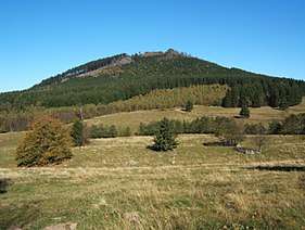
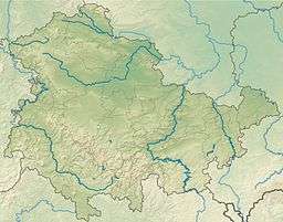
The Großer Hermannsberg is a mountain, 867 metres high, south of the main ridge of the Thuringian Forest in the county of Schmalkalden-Meiningen in Germany.
| Großer Hermannsberg | |
|---|---|
 Südseite | |
| Highest point | |
| Elevation | 867 m (2,844 ft) |
| Prominence | 140 m ↓ 700 m SE of the summit (near the source of the Dörmbach) |
| Isolation | 2.5 km → Finsterbachkopf (898.3 m) – east of the Haselbach and the Kanzlersgrund |
| Coordinates | 50°42′3″N 10°36′52″E |
| Geography | |
| Parent range | Thuringian Forest |
Location and area
To the north and immediately below the mountain is the village of Oberschönau and the adjacent Kanzlersgrund. Behind them is the main ridge of the Thuringian Forest with its long-distance trail, the Rennsteig. In front of the ridge are the mountains of Hohe Möst and Hoher Stein. To the southwest lies Bermbach, to the southeast is Zella-Mehlis and to the east is Oberhof.
Routes to the summit
- From Oberschönau or the Kanzlersgrund via the Oberschönau Hiking Hut (Ski- und Wanderhütte Oberschönau), past the plateau of the Kleiner Hermannsberg. From the Fuhrmannswiese pasture south of the mountain a path runs steeply uphill to the northern viewing rocks with their refuge hut. From this hut a path runs south to the main summit and its viewing rocks. As a return route a path can be taken from the Fuhrmannswiese on the north side of the mountain which returns to the hiker's hut.
- From the hiker's car park at the Knüllfeld the route heads for Ruppberg, before crossing the Fuhrmannswiese diagonally and continuing as above.
Summit description

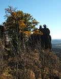
From the northern lookout rocks, the path runs along below the summit which, according to an inscription, is actually 873 metres high. From the path there is a further view of the Rhön mountains. Continuing towards the viewing rocks there is a view looking east by a small rock (see photograph below). The actual viewing rocks may be climbed using steps hewn out of the rock and a safety cable; the top is protected by railings. The top of these rocks is recorded on all the maps as being 867 metres high.
View

- North
- Oberschönau (from the northern viewing rocks)
- East
- Donnershauk, Hohe Möst
- Kanzlersgrund
- Schanzenanlage Kanzlersgrund, Hoher Stein
- Gebrannter Stein
- Schneekopf
- Southeast
- Ringberghaus and Adlersberg Tower near Suhl
- From south to northwest
- Gleichberge
- Dolmar
- Kreuzberg (Rhön)
- Hutsberg and Neuberg
- Hohe Geba
- Heidelstein and Wasserkuppe
- Diesburg and Leichelberg
- Milseburg
- Steinbach-Hallenberg
- Baier, Dietrichsberg, Öchsenberg, Kaliberge
- Altersbach and Rotterode
External links
| Wikimedia Commons has media related to Großer Hermannsberg. |
- Annotated view from the Großer Hermannsberg looking south and west at www.panorama-photo.net
