Grinderwald
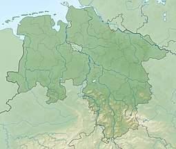
The Grinderwald is a mixed forest and a low hill range, up to 101 m above sea level (NN), in Hanover Region and the Lower Saxon district of Nienburg/Weser in Germany.
| Grinderwald | |
|---|---|
 Hanover Region, Nienburg/Weser | |
| Highest point | |
| Peak | Hüttenberg |
| Elevation | 101 m above NN |
| Geography | |
| Location | Hanover Region, Nienburg/Weser |
| Country | Germany |
| State | Lower Saxony |
| Range coordinates | 52.57167°N 9.37194°E |
Geology
The Grinderwald is an Old Drift plateau that was formed from deposits of boulders and debris during the Ice Age.
Hills
Amongst the high points in the hillocky terrain of the Grinderwalds are the following, sorted by height in metres (m) above sea level (NN):
- Hüttenberg (101 m)
- Himberg (98.8 m)
- Eckberge (91 m)
- Lichtenberg (85.4 m)
- Masekersberg (83.1 m)
- Spielberg (76.0 m)
- Lehmberg (72.8 m)
- Reihersberg (71 m)
- Brand (67.3 m)
- Uhlenberg (65.8 m)
- Saalhorstberg (62 m)
gollark: I'm not you more than 0.4% of the time or less though?
gollark: Lyricly is a higher kinded trait.
gollark: Ask esobot yourself.
gollark: <@435756251205468160>.
gollark: DDR5 is better than the audit log, though.
References
This article is issued from Wikipedia. The text is licensed under Creative Commons - Attribution - Sharealike. Additional terms may apply for the media files.