Great Sand Sea
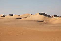
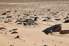
The Great Sand Sea is an approximately 72,000 km² sand desert (erg) in the Sahara between western Egypt and eastern Libya in North Africa. Some 74% of the area is covered by sand dunes.[1]
Great Sand Sea بحر الرمال العظيم | |
|---|---|
 The dunes of the Great Sand Sea near Siwa, Egypt | |
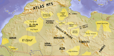
 Map of the topographic features of the Sahara | |
| Country | Egypt and Libya |
| Area | |
| • Total | 72,000 km2 (28,000 sq mi) |
| Elevation | 100 m (300 ft) |


Geography
The Great Sand Sea stretches for a length of about 650 km from north to south and a width of 300 km from east to west. On satellite images this desert shows a pattern of long sand ridges running in a roughly north-south direction. However, despite the apparent uniformity the Great Sand Sea has two large areas with different types of megadunes.[1] The Egyptian sand sea lies parallel to the Calanshio Sand Sea of Libya, with which it is contiguous in the north. The dunes of the Great Sand Sea cover about 10% of the total area of the Egyptian Western Desert.
Siwa is an oasis located in Egypt, about 50 km (30 mi) east of the Libyan border, in the eastern part of the Great Sand Sea or Egyptian Sand Sea.
Although well-known to the Tuareg and traders who traveled with caravans across the Sahara, Friedrich Gerhard Rohlfs was the first European to document the Great Sand Sea. He began his Saharan expeditions in 1865, and named the great expanse of dunes the Große Sandmeer, but it was not until 1924 with the maps of Ahmed Hassanein that the full scope of the Great Sand Sea was appreciated by Europeans.
See also
- Great Sand Sea Glass
- Libyan Desert
- Sahara
References
- Besler, Helga (2008) The Great Sand Sea in Egypt: Formation, Dynamics and Environmental Change: A Sediment-Analytical Approach Elsevier, Amsterdam, page 1 - 3, ISBN 978-0-444-52941-1
External links

- Egypt Travel - The Great Sand Sea
- Desert Geomorphology
- The Great Sand Sea - Rough Guides