Goudswaard
Goudswaard is a village in the Dutch province of South Holland, located on the westernmost tip of the Hoeksche Waard, approximately 6 km south-west of Spijkenisse. Goudswaard was a separate municipality from 1817 until 1984, when it was merged with Nieuw-Beijerland, Zuid-Beijerland and Piershil to form the municipality of Korendijk.[1] The built-up area of Goudswaard is 0.28 km².[2] As of 1 January 2014, the village has 1,956 inhabitants, and contains 804 residences.[3]
Goudswaard | |
|---|---|
Village | |
 Dorpsstraat 32-34 | |
 Flag  Coat of arms | |
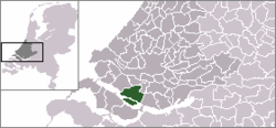 | |
 The village centre (dark green) and the statistical district (light green) of Goudswaard in the former municipality of Korendijk. | |
| Coordinates: 51°48′N 4°17′E | |
| Country | Netherlands |
| Province | South Holland |
| Municipality | Hoeksche Waard |
| Area | |
| • Total | 0.28 km2 (0.11 sq mi) |
| Population (January 2014) | |
| • Total | 1,956 |
| • Density | 7,000/km2 (18,000/sq mi) |
| Time zone | UTC+1 (CET) |
| • Summer (DST) | UTC+2 (CEST) |
Goudswaard was founded in 1439, simultaneously with the diking of the polder Oud Korendijk. The village itself was, and still is, sometimes known as Korendijk. It was connected to Rotterdam by tram from 1903 to 1956. The village houses a flour mill named Windlust.
References
- Ad van der Meer and Onno Boonstra, Repertorium van Nederlandse gemeenten, KNAW, 2011.
- Statistics Netherlands (CBS), Bevolkingskernen in Nederland 2001 Archived 2006-03-19 at the Wayback Machine. (Statistics are for the continuous built-up area).
- "Overzicht Korendijk in cijfers". Gemeente Korendijk (in Dutch). Retrieved 22 November 2014.
External links
- J. Kuyper, Gemeente Atlas van Nederland, 1865-1870, "Goudswaard". Map of the former municipality, around 1868.

This article is issued from Wikipedia. The text is licensed under Creative Commons - Attribution - Sharealike. Additional terms may apply for the media files.