Golis Mountains
The Golis Mountains[2] are a mountain range in Somaliland.[3] Also known as Qar Golis, they cut through the Togdheer region,[1] and end near the Gan Libah.[4]
| Golis | |
|---|---|
 Foothills of the mountain range | |
| Highest point | |
| Elevation | 1,371 m (4,498 ft) [1] |
| Coordinates | 9°52′0″N 44°55′0″E |
| Geography | |
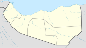 Golis Location of the Golis Mountains 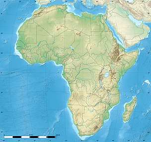 Golis Golis (Africa) | |
| Location | Togdheer, |
Jerato Pass
This range has a mountain pass known as the "Jerrato Pass".[4]
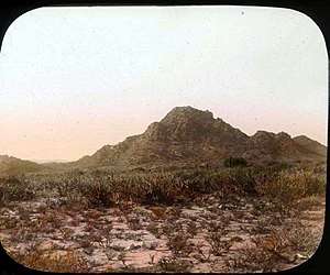
_Pass_(3948855536).jpg)
The Jerato or Gellato Pass, 1896
gollark: Why though?
gollark: I don't see how TJ09'd accidentally do this.
gollark: Maybe a copper.
gollark: What to buy...
gollark: AAAAAAA
See also
References
- "Golis Range, Somalia". Getamap. Retrieved 23 June 2013.
- Abdullahi, Mohamed Diriye (2001). Culture and customs of Somalia. Greenwood. ISBN 978-0-313-31333-2.CS1 maint: ref=harv (link)
- https://www.tandfonline.com/doi/abs/10.1080/03056244.2014.901945?journalCode=crea20
- Pease, A. E. (1913). "IV: Of dangerous game". The Book of the Lion. London: John Murray. pp. 46−68.
This article is issued from Wikipedia. The text is licensed under Creative Commons - Attribution - Sharealike. Additional terms may apply for the media files.