Gila Bend Municipal Airport
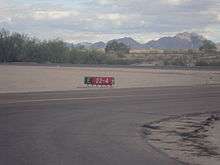
Gila Bend Municipal Airport (FAA LID: E63), is 2 miles (1.7 nmi; 3.2 km) east of Gila Bend, in Maricopa County, Arizona, United States.[1]
Gila Bend Municipal Airport | |||||||||||
|---|---|---|---|---|---|---|---|---|---|---|---|
| Summary | |||||||||||
| Airport type | Public | ||||||||||
| Owner/Operator | Town of Gila Bend | ||||||||||
| Serves | Gila Bend, Arizona | ||||||||||
| Elevation AMSL | 789 ft / 240 m | ||||||||||
| Coordinates | 32.9603°N 112.6741°W | ||||||||||
| Map | |||||||||||
 E63  E63 | |||||||||||
| Runways | |||||||||||
| |||||||||||
| Statistics (2012) | |||||||||||
| |||||||||||
Facilities
The airport covers 232 acres (94 ha) at an elevation of 789 feet (240 m). It has one runway:
It has a VORTAC (116.60 MHz) and it is a Lighted Land Airport.
In the year ending April 19, 2008 the airport had 3,500 general aviation aircraft operations, average 10 per day. No aircraft were then based at the airport.[1]
gollark: PotatOS!
gollark: For some reason - probably the same reason your `load` does something else - I have to go around constructing a new environment from scratch, including running the BIOS.
gollark: Yes, because it does a bit more.
gollark: Basically, in *yours*, `load` accesses the inner sandbox layer, but it didn't in mine before, so I had to bodge in a patch to load.
gollark: Line 123 and onward.
References
- FAA Airport Master Record for E63 (Form 5010 PDF). Federal Aviation Administration. Effective 29 July 2010.
External links
- Resources for this airport:
- FAA airport information for E63
- AirNav airport information for E63
- FlightAware airport information and live flight tracker
- SkyVector aeronautical chart for E63
This article is issued from Wikipedia. The text is licensed under Creative Commons - Attribution - Sharealike. Additional terms may apply for the media files.