Gijou
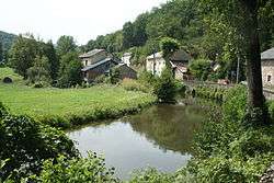
The Gijou (French: le Gijou) is a 50.0 km (31.1 mi) long river in the Tarn department in southern France. Its source is at Lacaune. It flows generally west-southwest. It is a right tributary of the Agout, into which it flows at Vabre.
| Gijou | |
|---|---|
 | |
.png) | |
| Location | |
| Country | France |
| Physical characteristics | |
| Source | |
| • location | Lacaune |
| • coordinates | 43°42′33″N 02°40′26″E |
| • elevation | 745 m (2,444 ft) |
| Mouth | |
• location | Agout |
• coordinates | 43°40′41″N 02°24′18″E |
• elevation | 285 m (935 ft) |
| Length | 50.0 km (31.1 mi) |
| Basin size | 208 km2 (80 sq mi) |
| Discharge | |
| • average | 4.63 m3/s (164 cu ft/s) |
| Basin features | |
| Progression | Agout→ Tarn→ Garonne→ Gironde estuary→ Atlantic Ocean |
Communes along its course
This list is ordered from source to mouth: Lacaune, Gijounet, Viane, Lacaze, Saint-Pierre-de-Trivisy, Vabre
Notes
- This article is based on the equivalent article from the French Wikipedia, consulted on 27 April 2009.
gollark: Currently, if someone gets unauthorized access to my computer, at worst they will have access to a bunch of personal information and passwords, but I can change the passwords and wipe the computer, although it would be somewhat tedious.
gollark: OLEDs still use polarizers except the shiny new Samsung stuff.
gollark: E-ink is kind of bad and expensive, same for CRTs, and micro-LED isn't there yet.
gollark: But then I can't use a computer.
gollark: Also also radio waves.
This article is issued from Wikipedia. The text is licensed under Creative Commons - Attribution - Sharealike. Additional terms may apply for the media files.