Geospatial Summary of the Research and Recreational facilities within the Juneau Icefield area
Juneau Icefield Research Camp Facilities
The Juneau Icefield Research Program (JIRP) and its parent organization, the Foundation for Glacier and Environmental Research (FGER), maintains several research facilities around the expanse of the Juneau Icefield for the purpose of providing educational and expeditionary experience to students with training in Earth sciences, wilderness survival, and mountaineering skills. These camps are private facilities and are operated in accordance with a U.S. Forest Service Special Use Permit, which stipulates that the facilities can be used only for educational and research purposes by the Juneau Icefield Research Program. Thus all non-JIRP related visitation and use of these camps is prohibited.[1]
| Facility | Established | Reference | CT | Peak | Remarks |
|---|---|---|---|---|---|
| C-4 | 19XX | [CT 1] | Camp-4 Peak | Location Approximate | |
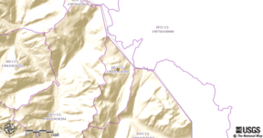
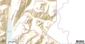
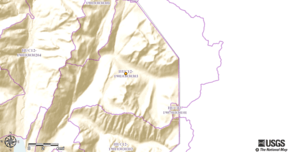
| C-8 | 195X | [2][NM 1] | [CT 2] | Mount Moore | Major Facility |
| C-9 | 19XX | [CT 3] | on upper Matthes Glacier | ||
| C-9B | 19XX | [2] | [CT 4] | Abandoned, loc approx. | |
| C-10 | 195X | [CT 5] | Vantage Peak | Major JIRP Facility | |
| C-10B | 195X | [2] | [CT 6] | N/A | Virtual Camp, Ski-plane landing area |
| C-12 | 19XX | [2] | [CT 7] | Lower Goat Ridge, Abandoned | |
| C-13 | 19XX | [CT 8] | Split Thumb | Location Approximate | |
| C-14 | 19XX | [2] | [CT 9] | Location approximate, Abandoned | |
| C-15 | 19XX | [2] | [CT 10] | Camp-15 Peak | Abandoned |
| C-16 | 195X | [2] | [CT 11] | Needs update | |
| C-17 | 1953 | [2] [NM 2] | [CT 12] | Cairn Peak | |
| C-17A | 196X | [CT 13] | At the end of the Lemon Creek Trail | ||
| C-18 | 19XX | [NM 3][CT 14] | Major JIRP Facility | ||
| C-18B | 19XX | [CT 15] | on lower Vaughan Lewis Glacier | ||
| C-19 | 19XX | [CT 16] | Watchamacallit Glacier in the Gilkey Canyon near site 18B | ||
| C-25 | 19XX | Mount Nesselrode | |||
| C-26 | 197X | [CT 17] | On a nunatak on the north side of the Llewellyn Glacier | ||
| C-29 | 19XX | [CT 18] | On Cathedral Glacier Massif, west of Torres Channel | ||
| C-29B | 19XX | N/A | At timberline and in alpine tundra zone near Cathedral Glacier terminus | ||
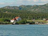
| C-30 | 1968 | [CT 19] | N/A | Atlin,British Columbia | |
Notes
- FFGR/JIRP Research Facilities
 Camp 17A (Awaiting photograph contribution)
 Camp-17 (Awaiting photograph contribution)
 Camp-10 (Awaiting photograph contribution)
 Camp-25 (Awaiting photograph contribution)
 Camp 8 (Awaiting photograph contribution)
 Camp-18 (Awaiting photograph contribution)
 Camp-26 (Awaiting photograph contribution)
 Camp-30 (Atlin, British Columbia)
USDA/Forest Service(USFS) Remote Campsites
The United States Forest Service(USFS) maintains several "Camps" around the expanse of the Icefield for recreational purposes.[DA 1] These are modest cabins that recreational hikers can reserve[DA 2] for overnight accommodations.
| Facility | Coordinates | Elevation | Reference | Trail | Trailhead | Length | Remarks |
|---|---|---|---|---|---|---|---|
| Upper Dewey Lake | 59°26′36″N 135°16′14″W | 3,097 ft (944 m) | Dewey Lake trail[NW 1] | 59°27′09″N 135°18′56″W | 0.0 mi | ||
| Eagle Glacier Cabin | 58°34′23″N 134°45′04″W | 190 ft (58 m) | [DA 3][DA 4] | Amalga trail | 58°31′42″N 134°48′28″W | 0.0 mi | Accessed from Glacier Highway MM27.2 |
| Berners Bay Cabin | 58°46′12″N 134°56′09″W | 15 ft (5 m) | [DA 5] | Watercraft | |||
| Laughton Glacier Cabin | 59°31′56″N 135°06′24″W | 15 ft (5 m) | [DA 6][NW 2] | Trail | |||
| Denver Glacier Cabin | 59°28′15″N 135°12′03″W | 15 ft (5 m) | [DA 7][NW 3] | Trail | |||
Notes
- USFS Remote Cabins
 USFS Berners Bay Cabin
 USFS Eagle Glacier Cabin
 Upper Dewey Lake Cabin
See also
- Geospatial Summary of the Juneau Icefield
- Geospatial Summary of the High Peaks/Summits of the Juneau Icefield
- USGS Historical Topographic Maps for the Juneau Icefield area
- Juneau Icefield
- List of glaciers and icefields
- List of Boundary Peaks of the Alaska–British Columbia/Yukon border
References
US Department of Agriculture/Forest Service(DA)
- "Tongass National Forest - Home". usda.gov.
- "Tongass National Forest - Camping & Cabins:Cabin Rentals". usda.gov.
- "Tongass National Forest - Eagle Glacier Cabin". usda.gov.
- "Tongass National Forest - Amalga Trail". usda.gov.
- "Tongass National Forest - Berner3As Bay Cabin". usda.gov.
- "Tongass National Forest - Laughton Glacier Cabin". usda.gov.
- "Tongass National Forest - Denver Caboose Cabin". usda.gov.
Organizations/Club Newsletters/Blogs/Reports/etc(NW)
- "Upper Dewey Lake". Yukon Hiking.
- "Laughton Glacier". Yukon Hiking.
- "Denver Glacier". Yukon Hiking.
Other
- "About". Juneau Icefield Research Program.
- Juneau Icefield Research Project (1949-1958), p. 16, at Google Books
Sources
Mapping Systems
Caltopo Mapping System(CT)
- "CalTopo - Backcountry Mapping Evolved". caltopo.com.
- "CalTopo - Backcountry Mapping Evolved". caltopo.com.
- "CalTopo - Backcountry Mapping Evolved". caltopo.com.
- "CalTopo - Backcountry Mapping Evolved". caltopo.com.
- "CalTopo - Backcountry Mapping Evolved". caltopo.com.
- "CalTopo - Backcountry Mapping Evolved". caltopo.com.
- "CalTopo - Backcountry Mapping Evolved". caltopo.com.
- "CalTopo - Backcountry Mapping Evolved". caltopo.com.
- "CalTopo - Backcountry Mapping Evolved". caltopo.com.
- "CalTopo - Backcountry Mapping Evolved". caltopo.com.
- "CalTopo - Backcountry Mapping Evolved". caltopo.com.
- "CalTopo - Backcountry Mapping Evolved". caltopo.com.
- "CalTopo - Backcountry Mapping Evolved". caltopo.com.
- "CalTopo - Backcountry Mapping Evolved". caltopo.com.
- "CalTopo - Backcountry Mapping Evolved". caltopo.com.
- "CalTopo - Backcountry Mapping Evolved". caltopo.com.
- "CalTopo - Backcountry Mapping Evolved". caltopo.com.
- "CalTopo - Backcountry Mapping Evolved". caltopo.com.
- "CalTopo - Backcountry Mapping Evolved". caltopo.com.
USGS National Map Viewer System(NM)
- "USGS TNM 2.0 Viewer". nationalmap.gov.
- "USGS TNM 2.0 Viewer". nationalmap.gov.
- "USGS TNM 2.0 Viewer". nationalmap.gov.