Georgia State Route 79
State Route 79 (SR 79) is a 26.7-mile-long (43.0 km) state highway in the east-central part of the U.S. state of Georgia. The highway travels from US 378/SR 43 in Lincolnton northwest to SR 72 at a point southeast of Elberton.
| ||||
|---|---|---|---|---|
| Elberton Highway, Lincolnton Highway | ||||
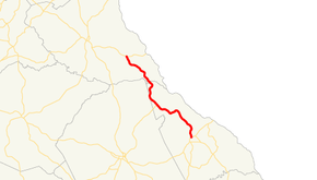 Georgia State Route 79 highlighted in red | ||||
| Route information | ||||
| Maintained by GDOT | ||||
| Length | 26.7 mi[1] (43.0 km) | |||
| Major junctions | ||||
| South end | ||||
| North end | ||||
| Location | ||||
| Counties | Lincoln, Elbert | |||
| Highway system | ||||
| ||||

Route description
SR 79 begins at an intersection with US 378/SR 43 (North Washington Street) in the northeastern part of Lincolnton, within the central part of Lincoln County. South of the intersection, the roadway continues as Goshen Street. The state highway travels to the north-northeast and almost immediately curves to the north-northwest. It leaves the city limits of Lincolnton and then curves back to the north-northeast. It curves back to the north-northwest and crosses over Soap Creek. During a northwestern direction of the highway, it travels through Goshen and crosses over Murry Creek. After curving back to the north-northwest, it crosses over Mill Creek. It curves to the southwest then resumes its generally north-northwest direction. It curves to the west-southwest and crosses over Fishing Creek. It bends to the northwest and enters Chennault. Here, the highway intersects the northern terminus of SR 44 and the southern terminus of Graball Road. A brief distance later, it crosses over Newford Creek. It curves back to the north-northwest and briefly parallels the Lincoln–Wilkes county line. After crossing over Pistol Creek, it curves to the northeast. It curves back to the northwest and travels between two portions of Clarks Hill Lake, where it enters the southeastern part of Elbert County. The highway winds its way to the north-northwest to its northern terminus, an intersection with SR 72 (Calhoun Falls Highway) southeast of Elberton.[1]
History
Major intersections
| County | Location | mi[1] | km | Destinations | Notes |
|---|---|---|---|---|---|
| Lincoln | Lincolnton | 0.0 | 0.0 | Southern terminus; roadway continues as Goshen Street. | |
| Chennault | 12.5 | 20.1 | Northern terminus of SR 44; southern terminus of Graball Road | ||
| Elbert | | 26.7 | 43.0 | Northern terminus; provides access to Elbert County Airport and Elbert Memorial Hospital | |
| 1.000 mi = 1.609 km; 1.000 km = 0.621 mi | |||||
See also
.svg.png)

References
- Google (November 19, 2019). "Overview map of SR 79" (Map). Google Maps. Google. Retrieved November 19, 2019.
External links
| Wikimedia Commons has media related to Georgia State Route 79. |