Georgia State Route 188
State Route 188 (SR 188) is a 35.2-mile-long (56.6 km) state highway that runs west-to-east through portions of Grady and Thomas counties in the southwestern part of the U.S. state of Georgia.
| ||||
|---|---|---|---|---|
 | ||||
| Route information | ||||
| Maintained by GDOT | ||||
| Length | 35.2 mi[1] (56.6 km) | |||
| Major junctions | ||||
| West end | ||||
| East end | ||||
| Location | ||||
| Counties | Grady, Thomas | |||
| Highway system | ||||
| ||||

Route description
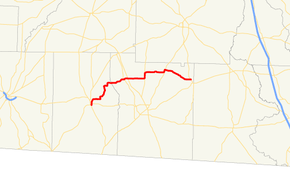
SR 188 begins at an intersection with SR 93 in Cairo, in Grady County. It heads north through town to an intersection with SR 38 Spur (1st Avenue NE). It continues north to meet US 84/SR 38, before leaving Cairo. It stair-steps its way to the northeast to meet SR 3 Alternate (Main Street) in Ochlocknee. It crosses into Thomas County on its way. On the eastern edge of town is an intersection with US 19/SR 3/SR 300. Farther to the east is a concurrency with SR 202. In Coolidge, the highway intersects US 319/SR 35 (Pine Street). SR 188 continues to the southeast and curves to the east to meet its eastern terminus, an intersection with SR 33 northwest to Pavo.[1]
SR 188 is not part of the National Highway System, a system of roadways important to the nation's economy, defense, and mobility.[2]

Major intersections
| County | Location | mi[1] | km | Destinations | Notes |
|---|---|---|---|---|---|
| Grady | Cairo | 0.0 | 0.0 | Western terminus | |
| 0.3 | 0.48 | ||||
| 0.7 | 1.1 | ||||
| Thomas | Ochlocknee | 14.4 | 23.2 | ||
| 15.5 | 24.9 | ||||
| | 20.2 | 32.5 | Western end of SR 202 concurrency | ||
| | 21.2 | 34.1 | Eastern end of SR 202 concurrency | ||
| Coolidge | 27.6 | 44.4 | |||
| | 35.2 | 56.6 | Eastern terminus | ||
1.000 mi = 1.609 km; 1.000 km = 0.621 mi
| |||||
See also
.svg.png)

References
- Google (June 22, 2013). "Route of SR 188" (Map). Google Maps. Google. Retrieved June 22, 2013.
- "National Highway System: Georgia" (PDF). United States Department of Transportation. May 8, 2009. Retrieved June 22, 2013.
External links

- Georgia Roads (Routes 181 - 200)