Gehrdener Berg
The Gehrdener Berg is a forested ridge in the Calenberg Land in Hanover Region in the north German state of Lower Saxony. On its slopes nestles the town of Gehrden that gives the ridge its name. The ridge is about 2.7 kilometres long and is the sister hill range of the Benther Berg in southwest Hanover. Its highest point is the Burgberg at 155 metres above sea level (NN).
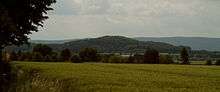
The Gehrdener Berg with the Deister in the background
| Gehrdener Berg | |
|---|---|
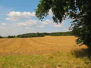 The Gehrdener Berg in late summer | |
| Highest point | |
| Elevation | 155 m above sea level (NN) (509 ft) |
| Prominence | 70 m → Deister |
| Isolation | 3.1 km → Benther Berg |
| Coordinates | 52°18′29″N 9°35′24″E |
| Geography | |
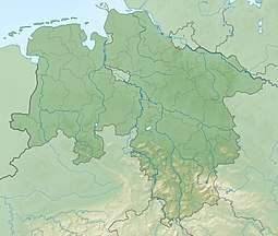 Gehrdener Berg | |
Sources
- Werner Fütterer: Gehrden – Vom Flecken zur Großgemeinde. Gehrden 1991
- August Kageler: Geschichte der Stadt Gehrden. Gehrden 1950
gollark: HONLU
gollark: You know, part of the reason the forums are aaaaaargh could be that the way the forum is structured (last updated thing most visible) encourages controversial stuff to go up and generally agreed-upon stuff to go down.]
gollark: 🗽
gollark: Great, isn't it...
gollark: But it's fine because TJ09 will just magically fix it*.* citation: my remove sickness thread's responses
This article is issued from Wikipedia. The text is licensed under Creative Commons - Attribution - Sharealike. Additional terms may apply for the media files.