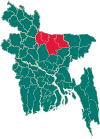
Gafargaon Upazila
Gafargaon (Bengali: গফরগাঁও) is an Upazila of Mymensingh District[1] in the Division of Mymensingh, Bangladesh.
Gafargaon গফরগাঁও | |
|---|---|
Upazila | |
 Gafargaon Location in Bangladesh | |
| Coordinates: 24°25′N 90°33′E | |
| Country | |
| Division | Mymensingh Division |
| District | Mymensingh District |
| Area | |
| • Total | 401.16 km2 (154.89 sq mi) |
| Population (2011) | |
| • Total | 430,746 |
| • Density | 1,100/km2 (2,800/sq mi) |
| Time zone | UTC+6 (BST) |
| Website | gafargaon |
Geography
Gafargaon is located at 24.4167°N 90.5500°E. It has 73,130 households and total area 401.16 km².
Demographics
According to the 2011 Bangladesh census, Gafargaon had a population of 430,746. Males constituted 48.90% of the population and females 51.10%. Muslims formed 98.49% of the population, Hindus 1.43% and others 0.08%. Gafargaon had a literacy rate of 49.26% for the population 7 years and above.[2]
As of the 1991 Bangladesh census, Gafargaon has a population of 379,803. Males constitute 51.04% of the population, and females 48.96%. This Upazila's eighteen up population is 184,633. Gafargaon has an average literacy rate of 90.3% (7+ years), and the national average of 70.4% literate.[3]
Administration
Gafargaon has a municipality, 2 police stations, 15 Unions/Wards, 203 Mauzas/Mahallas, and 218 villages. The police stations (thana) are Gafargaon and Pagla. Pagla thana was established in 2012.
Education
Gafargaon Islamia Govt. High School The Gafargaon Islamia Govt . High School is a well known secondary school, established 1906. It is situated at Gafargaon, Bangladesh. The geographical coordinates of Gafargaon Islamia Govt. High School are 24°27'25.83" North, 90°32'55.4" East.
Some information:
EIIN Code: 111523
Students: Around 2000-2500
Khairullah Govt. Girls High School
Another government school at Gafargaon mainly for girls, established 1941. It's situated at Gafargaon, near Shahid Belal Plaza (well known shopping complex). Some useful information:
School Code : 7526
Centre Code: (JSC): 493
(SSC): 296
EIIN Code: 111528
Datter Bazar Union Higher Secondary School
Datter Bazar Union High School is the another well known School in here. In 2012, college department is added with school.
In 2019, Datter Bazar Union Higher Secondary School gain Highest Rank. EIIN code: 111553
Beroi Taltola High School Beroi Taltola High School is one of the Oldest School in Gafargaon Upazila. This School have a marvelous History. Before 2010 it was only girl School. A famous Hindus woman Social Worker Jyoti was establish this school in her father's land. It's a fully rural school.
Others
According to Banglapedia, Kandipara Askar Ali High School, founded in 1906, is a notable secondary school.[1]
and beside have Abdur Rahman Degre College.
Notable residents
- Abdul Jabbar, Language Movement martyr, was born at Panchua village in 1919.[4]
- Shamsul Huda Panchbagi, Islamic scholar and politician.
See also
- Upazilas of Bangladesh
- Districts of Bangladesh
- Divisions of Bangladesh
- Narayanganj-Bahadurabad Ghat Line
References
- Kader, Shafiqul (2012). "Gaffargaon Upazila". In Islam, Sirajul; Jamal, Ahmed A. (eds.). Banglapedia: National Encyclopedia of Bangladesh (Second ed.). Asiatic Society of Bangladesh.
- "Bangladesh Population and Housing Census 2011: Zila Report – Mymensingh" (PDF). Table P01 : Household and Population by Sex and Residence, Table P05 : Population by Religion, Age group and Residence, Table P09 : Literacy of Population 7 Years & Above by Religion, Sex and Residence. Bangladesh Bureau of Statistics (BBS), Ministry of Planning, Government of the People’s Republic of Bangladesh. Retrieved 14 December 2018.
- "Population Census Wing, BBS". Archived from the original on 2005-03-27. Retrieved November 10, 2006.
- Begum, Dilruba (2012). "Jabbar, Abdul". In Islam, Sirajul; Jamal, Ahmed A. (eds.). Banglapedia: National Encyclopedia of Bangladesh (Second ed.). Asiatic Society of Bangladesh.
