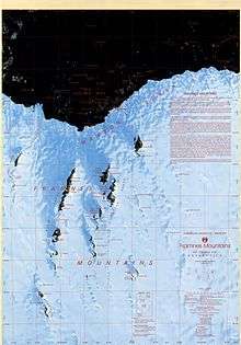
Framnes Mountains
The Framnes Mountains are an Antarctic mountain range consisting of Casey Range, Masson Range, David Range, and Brown Range, and adjacent peaks and mountains. The three major ranges and other lesser features were sighted and named in February 1931 by the British Australian New Zealand Antarctic Research Expedition under Douglas Mawson. This coast was also sighted by Norwegian whalers in the same season. The whole area was mapped in detail by Norwegian cartographers from aerial photographs taken by the Lars Christensen Expedition in January 1937. This overall name for the several ranges was given by Lars Christensen after Framnesfjellet, a hill near Sandefjord, Norway.[1]
Features of the Framnes Mountains
Further reading
External links
- Framnes Mountains on USGS website
- Framnes Mountains on AADC website
- Framnes Mountains on SCAR website
References
- "Framnes Mountains". Geographic Names Information System. United States Geological Survey. Retrieved 2012-04-06.
![]()