Fort George, Bombay
Fort George was an extension to the fortified walls of Bombay (now Mumbai) built in 1769; it was in the present-day Fort area, to the east of the site of the former Dongri Fort. The hill on which the Dongri fort stood was razed, and in its place Fort George was built. In 1862, the fort was demolished.
| Fort George | |
|---|---|
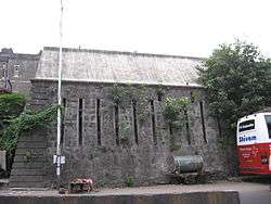 Remains of the fort wall near St. George Hospital | |
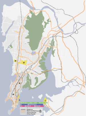 Location within Mumbai | |
| General information | |
| Type | Fort |
| Location | Fort, Mumbai |
| Coordinates | 18.94090°N 72.83759°E |
| Elevation | 13 m (43 ft) |
| Current tenants | St George Hospital |
| Completed | 1769 |
| Destroyed | 1862 |
| Client | British |
History
The fort was 1 mile (1.6 km) long and about one-third mile (500 m) wide. Its length ran from NNE to SSW, and it was named in honour of George III of the United Kingdom.
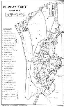
Plan of Bombay fort
gollark: <@683735247489466397> play bring me the horizon obey
gollark: 1
gollark: <@683735247489466397> play apioforms
gollark: Allegedly.
gollark: How goes it? I am working on a classified osmarks.net project.
See also
- List of forts in Maharashtra
References
This article is issued from Wikipedia. The text is licensed under Creative Commons - Attribution - Sharealike. Additional terms may apply for the media files.