Flying J Ranch Airport
Flying J Ranch Airport (FAA LID: E37) is a privately owned, public use non-towered airport owned by Howard E. Jenkins. The airport is located 4.6 miles (4.0 nmi; 7.4 km) southwest of the central business district of Pima, a city in Graham County, Arizona, United States and 79 miles (69 nmi; 127 km) northeast of Tucson International Airport.[1]
Flying J Ranch Airport | |||||||||||||||
|---|---|---|---|---|---|---|---|---|---|---|---|---|---|---|---|
 | |||||||||||||||
| Summary | |||||||||||||||
| Airport type | Public | ||||||||||||||
| Owner | Howard E. Jenkins | ||||||||||||||
| Serves | Pima, Arizona | ||||||||||||||
| Elevation AMSL | 3,114 ft / 949 m | ||||||||||||||
| Coordinates | 32°50′52″N 109°52′54″W | ||||||||||||||
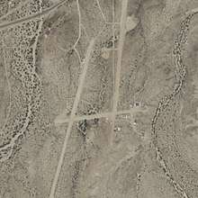
| Map | |||||||||||||||
 E37  E37 | |||||||||||||||
| Runways | |||||||||||||||
| |||||||||||||||
| Statistics (2015) | |||||||||||||||
| |||||||||||||||
Source: Federal Aviation Administration | |||||||||||||||
Although most U.S. airports use the same three-letter location identifier for the FAA, IATA, and ICAO this airport is only assigned E37 by the FAA.[2]
Facilities and aircraft
San Manuel Airport covers an area of 280 acres (110 ha) at an elevation of 3,114 ft (949 m) above mean sea level. According to the FAA the airport has two dirt runways:
- 18/36 measuring 2,950 ft × 45 ft (899 m × 14 m)
- 7/25 measuring 1,650 ft × 48 ft (503 m × 15 m)
The runways are described as being "extremely rough, rutted and has large rocks scattered on surface".[3]
For the 12-month period ending April 15, 2015, the airport had 200 aircraft operations, an average of 0.6 per day: 100% general aviation. At that time there were 8 aircraft based at this airport: 75% single-engine, no ultralight, 25% multi-engine, no jet, and no helicopters.
References
- "AirportIQ 5010". www.gcr1.com. Retrieved 2018-05-11.
- "E37 - Pima [Flying J Ranch Airport], AZ, US - Airport - Great Circle Mapper". www.gcmap.com. Retrieved 2018-05-11.
- "AirNav: E37 - Flying J Ranch Airport". www.airnav.com. Retrieved 2018-05-11.
External links
- FAA Terminal Procedures for E37, effective July 16, 2020
- Resources for this airport:
- FAA airport information for E37
- AirNav airport information for KE37
- FlightAware airport information and live flight tracker
- NOAA/NWS weather observations: current, past three days
- SkyVector aeronautical chart, Terminal Procedures