Florida State Road 608
State Road 608 (SR 608) is a 0.57-mile-long (0.92 km) east–west street serving the area north of Fort Pierce in St. Lucie County, Florida. Locally known as St. Lucie Boulevard, the road extends westward and eastward as County Road 608 (CR 608).
| ||||
|---|---|---|---|---|
| St. Lucie Boulevard | ||||
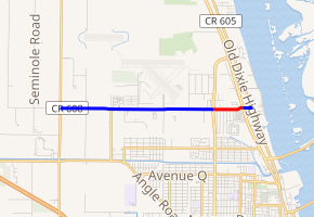
SR 608 in red, CR 608 in blue | ||||
| Route information | ||||
| Maintained by FDOT and St. Lucie County | ||||
| Length | 4.169 mi[1][2] (6.709 km) 0.569 miles (0.916 km) as SR 608[1] | |||
| Major junctions | ||||
| West end | ||||
| East end | ||||
| Highway system | ||||
| ||||


Its current western terminus is SR 613. The road becomes SR 608 at an intersection with SR 615, and the eastern terminus is an intersection with U.S. Route 1 (US 1 and SR 5), where the CR 608 designation resumes for one block to Dixie Highway (CR 605) in the Hunt Subdivision.
History
Originally, SR 608 extended westward another 3 miles (4.8 km), terminating at Kings Highway (SR 713), a heavily used two-lane road connecting Florida's Turnpike (SR 91) with US 1. This is now County Road 608, which serves the St. Lucie County Airport.
Major intersections
The entire route is in St. Lucie County.
| Location | mi[1][2] | km | Destinations | Notes | |
|---|---|---|---|---|---|
| | 0.0 | 0.0 | |||
| Fort Pierce North | 1.0 | 1.6 | Northern terminus of CR 611 | ||
| 3.0 0.000 | 4.8 0.000 | Transition from CR 608 to SR 608 | |||
| 0.569 0.0 | 0.916 0.0 | Unsigned SR 5; transition from SR 608 to CR 608 | |||
| St. Lucie | 0.2 | 0.32 | |||
1.000 mi = 1.609 km; 1.000 km = 0.621 mi
| |||||
References
- FDOT straight line diagrams Archived March 6, 2014, at the Wayback Machine, accessed March 2014
- Google (June 17, 2019). "Florida State Road 608" (Map). Google Maps. Google. Retrieved June 17, 2019.