Florida State Road 363
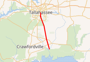
State Road 363 (SR 363) is a north–south route in the Big Bend region of Florida.
| ||||
|---|---|---|---|---|
| ||||
| Route information | ||||
| Maintained by FDOT | ||||
| Length | 20.198 mi[1] (32.506 km) | |||
| Major junctions | ||||
| South end | Riverside Drive in St. Marks | |||
| North end | ||||
| Location | ||||
| Counties | Wakulla, Leon | |||
| Highway system | ||||
| ||||

Route description
The road begins in St. Marks at Riverside Drive. From there, the road progresses north, intersecting US 98 and State Road 267 before leaving Wakulla County. In Leon County and approaching Tallahassee, the road intersects US 319 and CR 259. Just north of CR 259, SR 363 shares a brief concurrency with State Road 61 before veering west one block of SR 61 and continuing north in Tallahassee, parraeeling SR 61 one block to the west. It crosses the CSX Railroad tracks in downtown Tallahassee on the M. S. Thomas Bridge. For the last four blocks of the highway, SR 363 becomes a one way pair, ending at State Road 371 near the state capitol.[2]
Major intersections
| County | Location | mi[1] | km | Destinations | Notes |
|---|---|---|---|---|---|
| Wakulla | St. Marks | 0.000 | 0.000 | Riverside Drive | |
| | 2.582 | 4.155 | |||
| Wakulla | 5.596 | 9.006 | |||
| Leon | Woodville | 11.237 | 18.084 | ||
| 11.830 | 19.039 | ||||
| Tallahassee | 15.800 | 25.428 | |||
| 17.448 | 28.080 | Gaile Avenue (SR 61A west) | |||
| 17.733 | 28.538 | ||||
| 17.940 | 28.872 | South end of SR 61 overlap | |||
| 18.124 | 29.168 | North end of SR 61 overlap | |||
| 18.636 | 29.992 | ||||
| 20.198 | 32.506 | ||||
| 1.000 mi = 1.609 km; 1.000 km = 0.621 mi | |||||
gollark: I think that as long as teleportation was shown to be safe the ethical/philosophical issues would be outweighed by practicality pretty fast. I personally don't care about the continuity thing, however that's meant to work.
gollark: Not really the philosophy side, more "you can duplicate people" and "you can duplicate *things*".
gollark: They never consider the implications of that sort of replicator/teleporter technology.
gollark: Though I might be a bit worried about it since it *might* randomly disintegrate me or something if there's a bug in the reassembly bit.
gollark: If it's a very accurate reconstruction, I personally don't really mind.
References
- FDOT straight line diagrams Archived March 6, 2014, at the Wayback Machine, accessed March 2014
- Map of State Road 363 (Map). MapQuest, Inc. 2009. Retrieved 2011-06-19.
External links
This article is issued from Wikipedia. The text is licensed under Creative Commons - Attribution - Sharealike. Additional terms may apply for the media files.