Floßbach (Isenach)
The Floßbach (also Floßgraben or Floßkanal, formerly Flotzbach or Flotzbachgraben) is a manmade river, a good 16 kilometres long, and an orographically right-hand tributary of the Isenach, in the German state of Rhineland-Palatinate. It was built in the 18th century to enable the timber rafting of firewood.
| Floßbach | |
|---|---|
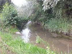 Mouth of the Stechgraben on the Floßbach (Floßbach from l to r) | |
| Location | |
| Location | Germany
|
| Reference no. | DE: 2391488 |
| Physical characteristics | |
| Source | |
| • location | Diversion: Northeast of Schifferstadt to the left from the Rehbach |
| • coordinates | 49°24′02″N 8°23′30″E |
| • elevation | ca. 95 m above sea level (NHN) [1] |
| Mouth | |
• location | East of Lambsheim from the right into the Isenach |
• coordinates | 49°30′24″N 8°18′18″E |
• elevation | ca. 92 m above sea level (NHN) [1] |
| Length | 16.04 km [2] |
| Basin size | 169.328 km² [2] |
| Basin features | |
| Progression | Isenach→ Rhine→ North Sea |
| Tributaries | |
| • left | Schwabenbach, Stechgraben |
References
- Topographical map, 1:25,000 series
- Wasserwirtschaftsverwaltung Rheinland-Pfalz
External links
Literature
- Wolfgang Kunz: Die Trift auf dem „Floßbach“. In: Ders., Henning Cramer, Wolfgang Fluck: Maxdorf. Geschichte und Natur. Knecht-Verlag, Landau, 2014, ISBN 978-3-939427-19-3, S. 147–165.
- Bernd-Stefan Grewe: Der versperrte Wald. Ressourcenmangel in der bayerischen Pfalz (1814–1870) (= Umwelthistorische Forschungen, Bd. 1). Böhlau Verlag, Cologne/Weimar/Vienna, 2004, ISBN 3-412-10904-5, pp. 292–302 (covers timber rafting in the Palatinate in general; for the Floßbach see p. 293).
This article is issued from Wikipedia. The text is licensed under Creative Commons - Attribution - Sharealike. Additional terms may apply for the media files.