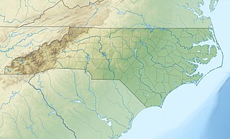
Flat Creek (Swannanoa River tributary)
Flat Creek is a 5.39 mi (8.67 km) long 2nd order tributary to the Swannanoa River in Buncombe County, North Carolina. It is impounded at Montreat Reservoir and Lake Susan.
| Flat Creek Tributary to Swannanoa River | |
|---|---|
 Location of Flat Creek mouth  Flat Creek (Swannanoa River tributary) (the United States) | |
| Location | |
| Country | United States |
| State | North Carolina |
| County | Buncombe |
| City | Black Mountain Montreat |
| Physical characteristics | |
| Source | divide between Flat Creek and Catawba River |
| • location | about 0.5 miles south of Graybeard Mountain |
| • coordinates | 35°40′40″N 082°17′24″W[1] |
| • elevation | 4,600 ft (1,400 m)[2] |
| Mouth | Swannanoa River |
• location | Black Mountain, North Carolina |
• coordinates | 35°37′07″N 082°18′55″W[1] |
• elevation | 2,359 ft (719 m)[2] |
| Length | 5.39 mi (8.67 km)[3] |
| Basin size | 6.04 square miles (15.6 km2)[4] |
| Discharge | |
| • location | Swannanoa River |
| • average | 11.05 cu ft/s (0.313 m3/s) at mouth with Swannanoa River[4] |
| Basin features | |
| Progression | southwest |
| River system | French Broad River |
| Tributaries | |
| • left | Puncheon Branch |
| • right | Slaty Branch Big Piney Branch Piney Branch |
| Waterbodies | Montreat Reservoir Lake Susan |
| Bridges | Calvin Trail, Graybeard Trail, Lookout Road, Texas Road, Shenandoah Terrace, Maryland Place, Flat Creek Road, East Street, E Cotton Avenue, Village Way, E State Street |
Course
Flat Creek rises about 0.5 miles south of Graybeard Mountain in Buncombe County on the Catawba River divide. Flat Creek then flows southwest through Montreat to meet the Swannanoa River at Black Mountain, North Carolina.[2]
Watershed
Flat Creek drains 6.04 square miles (15.6 km2) of area, receives about 52.4 in/year of precipitation, has a topographic wetness index of 261.49 and is about 79% forested.[4]
gollark: æ
gollark: tHIS ACTUALLY COULD sorry caps lock be interesting.
gollark: apt bad, pacman better
gollark: Intereßting idea!
gollark: Used PHP. Possibly.
References
- "GNIS Detail - Flat Creek". geonames.usgs.gov. US Geological Survey. Retrieved 12 October 2019.
- "Black Mountain Topo Map, Buncombe County NC (Black Mountain Area)". TopoZone. Locality, LLC. Retrieved 12 October 2019.
- "ArcGIS Web Application". epa.maps.arcgis.com. US EPA. Retrieved 12 October 2019.
- "Flat Creek Watershed Report". Waters Geoviewer. US EPA. Retrieved 12 October 2019.
This article is issued from Wikipedia. The text is licensed under Creative Commons - Attribution - Sharealike. Additional terms may apply for the media files.