Fitilieu
Fitilieu is a former commune in the Isère department in southeastern France. On 1 January 2016, it was merged into the new commune of Les Abrets-en-Dauphiné.[2]
Fitilieu | |
|---|---|
Part of Les Abrets-en-Dauphiné | |
.JPG) Train station | |
Location of Fitilieu 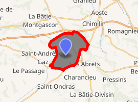
| |
 Fitilieu  Fitilieu | |
| Coordinates: 45°32′51″N 5°33′43″E | |
| Country | France |
| Region | Auvergne-Rhône-Alpes |
| Department | Isère |
| Arrondissement | La Tour-du-Pin |
| Canton | Chartreuse-Guiers |
| Commune | Les Abrets-en-Dauphiné |
| Area 1 | 10.01 km2 (3.86 sq mi) |
| Population (2017)[1] | 1,918 |
| • Density | 190/km2 (500/sq mi) |
| Time zone | UTC+01:00 (CET) |
| • Summer (DST) | UTC+02:00 (CEST) |
| Postal code | 38490 |
| Elevation | 280–407 m (919–1,335 ft) |
| 1 French Land Register data, which excludes lakes, ponds, glaciers > 1 km2 (0.386 sq mi or 247 acres) and river estuaries. | |
Geography
The Bourbre forms most of the commune's western border.
Population
| Year | Pop. | ±% |
|---|---|---|
| 1793 | 870 | — |
| 1806 | 1,055 | +21.3% |
| 1821 | 1,078 | +2.2% |
| 1831 | 1,433 | +32.9% |
| 1841 | 1,422 | −0.8% |
| 1851 | 1,413 | −0.6% |
| 1861 | 1,288 | −8.8% |
| 1872 | 1,246 | −3.3% |
| 1881 | 1,280 | +2.7% |
| 1891 | 1,260 | −1.6% |
| 1901 | 1,124 | −10.8% |
| 1911 | 1,028 | −8.5% |
| 1921 | 894 | −13.0% |
| 1931 | 1,007 | +12.6% |
| 1946 | 953 | −5.4% |
| 1962 | 1,102 | +15.6% |
| 1968 | 1,046 | −5.1% |
| 1975 | 1,083 | +3.5% |
| 1982 | 1,224 | +13.0% |
| 1990 | 1,262 | +3.1% |
| 1999 | 1,275 | +1.0% |
| 2008 | 1,584 | +24.2% |
| 2011 | 1,754 | +10.7% |
gollark: School maths is ÆÆææææÆÆÆÆÆææææÆÆÆÆÆÆÆÆæææÆÆÆÆÆAaaææææaaaaAAAÆÆÆææaaæÆAAÆÆÆa for several reasons but maths *generally* is cool.
gollark: I disagree.
gollark: Imagine having legs.
gollark: That sure is a band of some kind?
gollark: I disagree with this.
See also
References
| Wikimedia Commons has media related to Fitilieu. |
| Authority control |
|
|---|
This article is issued from Wikipedia. The text is licensed under Creative Commons - Attribution - Sharealike. Additional terms may apply for the media files.