Farnell County
Farnell County is one of the 141 Cadastral divisions of New South Wales.
| Farnell New South Wales | |||||||||||||||
|---|---|---|---|---|---|---|---|---|---|---|---|---|---|---|---|
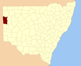 Location in New South Wales | |||||||||||||||
| |||||||||||||||
Farnell County was named in honour of the Premier of New South Wales James Squire Farnell (1825-1888).[1]
Parishes within this county
A full list of parishes found within this county; their current LGA and mapping coordinates to the approximate centre of each location is as follows:
| Parish | LGA | Coordinates |
|---|---|---|
| Alberta | Unincorporated | 31°23′10″S 141°23′54″E |
| Avenel | Unincorporated | 30°39′16″S 141°04′47″E |
| Badjerrigarn | Unincorporated | 31°12′35″S 141°29′25″E |
| Bligh | Unincorporated | 31°14′39″S 141°30′09″E |
| Boco | Unincorporated | 31°00′51″S 141°12′49″E |
| Border | Unincorporated | 30°30′40″S 141°04′47″E |
| Brunker | Unincorporated | 30°57′16″S 141°04′46″E |
| Burgess | Unincorporated | 30°35′06″S 141°15′32″E |
| Byjerkerno | Unincorporated | 31°25′12″S 141°34′44″E |
| Campbell | Unincorporated | 31°28′22″S 141°05′31″E |
| Chamberlain | Unincorporated | 31°09′52″S 141°13′56″E |
| Cook | Unincorporated | 31°09′58″S 141°21′43″E |
| Coonbaralba | Unincorporated | 31°31′14″S 141°33′20″E |
| Corona | Unincorporated | 31°17′26″S 141°23′59″E |
| Cultee | Unincorporated | 30°56′07″S 141°24′37″E |
| Dering | Unincorporated | 31°27′43″S 141°35′53″E |
| Floods Creek | Unincorporated | 30°51′09″S 141°38′54″E |
| Fowlers Gap | Unincorporated | 31°00′58″S 141°36′01″E |
| Giles | Unincorporated | 30°59′20″S 141°42′07″E |
| Glenmore | Unincorporated | 31°09′43″S 141°04′49″E |
| Gould | Unincorporated | 30°37′04″S 141°28′01″E |
| Harris | Unincorporated | 31°13′48″S 141°14′41″E |
| Kantappa | Unincorporated | 31°20′13″S 141°14′09″E |
| Mulcatcha | Unincorporated | 31°27′34″S 141°14′27″E |
| Patterson | Unincorporated | 31°03′05″S 141°20′06″E |
| Stanley | Unincorporated | 30°47′49″S 141°04′46″E |
| Sturt | Unincorporated | 31°05′48″S 141°28′10″E |
| Table Top | Unincorporated | 30°41′31″S 141°37′18″E |
| Tanyarto | Unincorporated | 31°08′39″S 141°36′52″E |
| Teilta | Unincorporated | 30°52′05″S 141°14′37″E |
| Torrowangee | Unincorporated | 31°28′57″S 141°23′59″E |
| Wammerra | Unincorporated | 30°46′06″S 141°24′49″E |
| Wonna | Unincorporated | 30°41′34″S 141°15′08″E |
| Yowahro | Unincorporated | 31°14′17″S 141°05′38″E |
gollark: Fair. Maybe there's a gap in the market for better online teaching of this stuff, somehow.
gollark: It's not like you can't learn stuff school doesn't cover, though.
gollark: I'm looking at the AQA one here, as my school seems to have arbitrarily chosen that.
gollark: I'm not sure if you get to pick them individually or if it's as a class somehow.
gollark: As well as the basic stuff the spec we're doing has "Astrophysics", "Medical physics", "Turning points in physics", "Engineering physics (re-branded Applied physics)" and "Electronics" options, it seems.
References
- "Farnell County". Geographical Names Register (GNR) of NSW. Geographical Names Board of New South Wales.

This article is issued from Wikipedia. The text is licensed under Creative Commons - Attribution - Sharealike. Additional terms may apply for the media files.