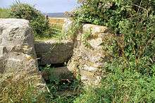
Ellenglaze
Ellenglaze (Cornish: Elynglas, (meaning is unclear, the Domesday entry is "Elil" meaning unknown at present and the "glaze" comes later and can mean green or sea green) is a hamlet near the village of Cubert north of Perranporth in Cornwall, England.[1] It lies close to the edge of Penhale Sands (dunes).

History
The manor of Ellenglaze is recorded in the Domesday Book as "Elil" and belonging to the monastery of Bodmin and having 2 hides of land and land for 8 ploughs. The monastery had 4 ploughs and 4 serfs there. There were also 8 villeins, 8 smallholders, half a square league of pasture and 20 sheep. The value of it was £1 sterling.[2] "Elil" was at one time identified with a place in the hundred of East Wivelshire.[3] It is the location of a former lead mine, abandoned in 1839.[4]
Ellenglaze Manor is a Grade II listed building, probably dating from the mid-late 17th century, with later alterations.[5]
References
- Ordnance Survey: Landranger map sheet 200 Newquay & Bodmin (Map). Ordnance Survey. ISBN 978-0-319-22938-5.
- Thorn, C. et al., ed. (1979) Cornwall. Chichester: Phillimore; entry 4, 18
- Domesday book online. "Ellenglaze - Domesday Book". Archived from the original on 2 April 2015. Retrieved 27 June 2012.
- mindat.org. "Ellenglaze Mine, Cubert". Retrieved 27 June 2012.
- British Listed Buildings. "Ellenglaze Manor - Cubert". Retrieved 27 June 2012.