Edwards Mountain
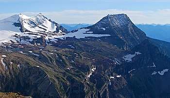
Edwards Mountain (9,076 feet (2,766 m)) is located in the Lewis Range, Glacier National Park in the U.S. state of Montana.[3] Edwards Mountain rises just to the west of Sperry Glacier. Based on the Köppen climate classification, Edwards Mountain has an alpine climate characterized by long, usually very cold winters, and short, cool to mild summers.[4] Temperatures can drop below −10 °F with wind chill factors below −30 °F.
| Edwards Mountain | |
|---|---|
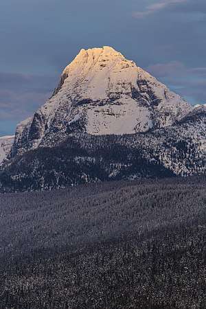 Edwards Mountain sunset | |
| Highest point | |
| Elevation | 9,076 ft (2,766 m) [1] NAVD 88 |
| Prominence | 1,072 ft (327 m) [1] |
| Coordinates | 48°37′22″N 113°47′10″W [2] |
| Geography | |
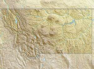 Edwards Mountain Location in Montana  Edwards Mountain Location in the United States | |
| Location | Flathead County, Montana, U.S. |
| Parent range | Lewis Range |
| Topo map | USGS Lake McDonald East, MT |
| Climbing | |
| First ascent | Unknown |
Geology
Like other mountains in Glacier National Park, Edwards Mountain is composed of sedimentary rock laid down during the Precambrian to Jurassic periods. Formed in shallow seas, this sedimentary rock was initially uplifted beginning 170 million years ago when the Lewis Overthrust fault pushed an enormous slab of precambrian rocks 3 mi (4.8 km) thick, 50 miles (80 km) wide and 160 miles (260 km) long over younger rock of the cretaceous period.[5]
See also
- Mountains and mountain ranges of Glacier National Park (U.S.)
- Geology of the Rocky Mountains
References
- "Edwards Mountain, Montana". Peakbagger.com. Retrieved June 7, 2018.
- "Edwards Mountain". Geographic Names Information System. United States Geological Survey. Retrieved June 7, 2018.
- Lake McDonald East, MT (Map). TopoQwest (United States Geological Survey Maps). Retrieved June 7, 2018.
- Peel, M. C.; Finlayson, B. L. & McMahon, T. A. (2007). "Updated world map of the Köppen−Geiger climate classification". Hydrol. Earth Syst. Sci. 11: 1633–1644. ISSN 1027-5606.
- Gadd, Ben (2008). "Geology of the Rocky Mountains and Columbias". Cite journal requires
|journal=(help)