Ebersberg (Deister)
The Ebersberg lies on the southern slopes of the Deister ridge in Germany.
| Ebersberg | |
|---|---|
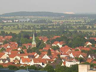
 View from the Ebersberg of Springe. In the background is the waste tip of the Siegfried-Giesen Potash Works | |
| Highest point | |
| Elevation | 355.1 m above sea level (NN) (1,165 ft) |
| Prominence | 5 m |
| Isolation | 0.8 km → Fahrenbrink |
| Coordinates | 52°12′45″N 9°31′44″E |
| Geography | |
 Ebersberg | |
| Parent range | Deister |
Location
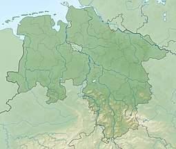
The hill is located southwest of the city of Hanover. On its slopes is the town of Springe.
Ascent
There are numerous footpaths in the Deister which offer several options for climbing the Ebersberg. The ascent from Springe itself is steep.
 Hillside on the Ebersberg
 Bulb symbol on the Göbel Bastei above Springe with memorial plaque for Heinrich Göbel
 Antenna site on the domed summit of the Ebersberg.
Sights
On the hillside aboveSpringe the Göbelbastei with its permanently lit light commemorates Heinrich Göbel who was born in Springe. From here there is a good view of the town. In good weather, visitors can see as far as the Brocken in the Harz mountains.
At the foot of the hill is the Ebersberg glacial erratic (Findling am Ebersberg), a recognised natural monument.
gollark: OIR™ input will occur shortly.
gollark: ++radio connect
gollark: ++help radio
gollark: You can just use headphones and be utterly silent however.
gollark: Oh right, config.
This article is issued from Wikipedia. The text is licensed under Creative Commons - Attribution - Sharealike. Additional terms may apply for the media files.