Dyleň
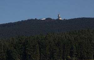
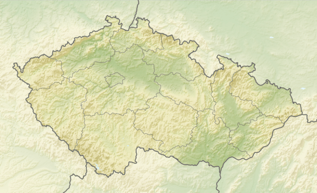
Dyleň (German: Tillenberg) is a mountain in the Karlovy Vary Region of western Bohemia, located roughly 100 metres (330 ft) from the Czech Republic–Germany border. At 939 metres (3,081 ft) above sea level, its summit is the second highest peak in the Upper Palatinate Range (Bavarian–Bohemian Forest).
| Dyleň | |
|---|---|
 | |
| Highest point | |
| Elevation | 939 m (3,081 ft) |
| Coordinates | 49°58′4″N 12°30′10″E |
| Geography | |
 Dyleň Czech Republic | |
| Location | Karlovy Vary Region, Czech Republic |
| Parent range | Bohemian Forest |
Local tradition holds that Napoleon Bonaparte declared Tillenberg the geographical center of Europe in 1813.[1]
The German name lent itself to the title of the epic poem Der Tillenberg: Ein Sagenschatz aus dem Egerlande (A Treasure-tale from the Egerland) published in 1904 by Ernst Freimut (pseudonym of Johann (Hans) Sommert).[2]
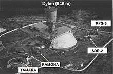
On its summit is a set of prominent buildings. These were used by the Soviet Union for electronic espionage into Germany during the Cold War. Now it is radio and television transmission tower.
Notes
- "Upper Palatinate: a Unique Place". Oberpfalz.de. Archived from the original on 2008-03-30. Retrieved 2009-04-18.
- Švandrlík, Richard (January 31, 2001). "Osobnosti Mariánských Lázní". Hamelika (in Czech). XXV (311). Retrieved 2009-04-18.