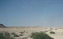
Dukhan Field
Dukhan Field is a large petroleum-producing field extending over an area of approximately 80 km in Dukhan, Qatar. The first well was drilled in 1939/1940 and the first export of petroleum from Dukhan went out in 1949.[1] The field produces up to 335,000 barrels (53,300 m3) of crude oil per day.

Overview
The onshore Dukhan field, located along the west coast of the peninsula, is the country's largest producing oil field.[2] The field is roughly 70 kilometres (43 mi) long and between 4 kilometres (2.5 mi) to 6 kilometres (3.7 mi) wide.[3] It contains four reservoirs: Khatiyah, Fahahil and Jaleha/Diyab, three are oil reservoirs, and one contains non-associated gas. Oil and gas are separated in four degassing stations: Khatiyah North, Khatiyah Main, Fahahil Main and Jaleha. Stabilized crude is transported by pipeline to the Mesaieed port.
History
Exploratory drilling was initiated in 1938 on the Dukhan anticline and, in 1939, the initial oil well was struck in the Number 3 Limestone of the Qatar Formation. Operations were put on hold temporarily in 1942 due to the Second World War but were resumed in 1947. In 1949, oil was discovered in two reservoirs of the Upper Jurassic Arab Formation known as Arab C and Arab D.[4] On 28 March 1953, a massive fire erupted at well DK35, which was drilling the Arab-D reservoir.[5]
As of 2015 an aggregate of 80 wells have been finished in the Dukhan Field.[6]
Geology
The Dukhan Field is situated on the Dukhan anticline, a group of folds which runs in a NNW to SSE direction parallel with the western coast.[7] The Dukhan anticline, with its thin lengthened structure and moderately steep dips stands out from the greater part of the neighboring folds. This has prompted some geologists to associate its formation with deep-seated salt movement.[8] The overall length of the anticline is roughly 80 km above the lowest closing contour.[9] Jebel Nakhsh lies at the southern boundary of the anticline.[10]
The Dukhan anticline demonstrates a range in the extremity of folding along its length; the folding of the northern part being more pronounced than the southern.[11] Intricate mapping of the anticline was carried out in 1948–49.[6]
References
- "Dukhan". Qatar Petroleum. Retrieved 3 August 2015.
- EIA 2007
- Qatar General Petroleum Company & Amoco Petroleum Company (1991). "Dukhan Field--Qatar Arabian Platform". Doha, Qatar. p. 103. Retrieved 24 February 2019.
- Nat P. Stephens, Dave Puls, Hilal Albotrous, Hussain Al-Ansi & Al-Tamimi Fahad (January 2009). Sequence Stratigraphic Framework of the Arab Formation Reservoirs, Dukhan Field, Qatar. Society of Petroleum Engineers - International Petroleum Technology Conference. Retrieved 24 February 2019.CS1 maint: uses authors parameter (link)
- Michael Quentin Morton (July 2018). "Darkening Skies: The Qatar Well Fires of the 1950s". AAPG Explorer. Retrieved 17 May 2020.
- Jacques Leblanc (December 2015). "A Historical Account of the Stratigraphy of Qatar, Middle-East (1816 to 2015)": 950-951. Retrieved 24 February 2019. Cite journal requires
|journal=(help) - Jacques Leblanc (March 2008). "A Fossil Hunting Guide To the Tertiary Formations of Qatar, Middle East". academia.edu. p. 25. Retrieved 24 February 2019.
- Jacques Leblanc (December 2015). "A Historical Account of the Stratigraphy of Qatar, Middle-East (1816 to 2015)": 954. Retrieved 24 February 2019. Cite journal requires
|journal=(help) - Jacques Leblanc (December 2015). "A Historical Account of the Stratigraphy of Qatar, Middle-East (1816 to 2015)": 69. Retrieved 24 February 2019. Cite journal requires
|journal=(help) - Jacques Leblanc (December 2015). "A Historical Account of the Stratigraphy of Qatar, Middle-East (1816 to 2015)": 53. Retrieved 24 February 2019. Cite journal requires
|journal=(help) - Jacques Leblanc (December 2015). "A Historical Account of the Stratigraphy of Qatar, Middle-East (1816 to 2015)": 389. Retrieved 24 February 2019. Cite journal requires
|journal=(help)
- Foreign ministry of Qatar's description of Dukhan Field
- The Qatar Oil Discoveries, Rasoul Sorkhabi, Ph.D., in GEO ExPro Magazine, Vol. 7, No. 1 - 2010 http://www.geoexpro.com/articles/2010/01/the-qatar-oil-discoveries