Dudley County
Dudley County is one of the 141 Cadastral divisions of New South Wales. Part of the southern border near the coast is the Apsley River.
| Dudley New South Wales | |||||||||||||||
|---|---|---|---|---|---|---|---|---|---|---|---|---|---|---|---|
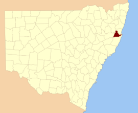 Location in New South Wales | |||||||||||||||
| |||||||||||||||
Dudley County was named in honour of Dudley Ryder, Second Earl of Harrowby (1798-1882).[1]
Parishes within this county
A list of parishes found within this county; their LGA and mapping coordinates to the approximate centre of each location is as follows:
| Parish | LGA | Coordinates |
|---|---|---|
| Bandi Bandi | Kempsey Shire Council | 31°06′54″S 152°30′04″E |
| Barraganyatti | Kempsey Shire Council | 30°51′54″S 152°56′04″E |
| Bellbrook | Kempsey Shire Council | 30°46′54″S 152°33′04″E |
| Boonanghi | Kempsey Shire Council | 31°04′54″S 152°36′04″E |
| Burragong | Kempsey Shire Council | 30°57′54″S 152°42′04″E |
| Clarke | Kempsey Shire Council | 30°59′54″S 152°20′04″E |
| Cliffs | Kempsey Shire Council | 30°32′54″S 152°25′04″E |
| Clybucca | Kempsey Shire Council | 30°55′54″S 152°58′04″E |
| Collombatti | Kempsey Shire Council | 30°55′54″S 152°45′04″E |
| Comara | Kempsey Shire Council | 30°37′54″S 152°22′04″E |
| Cooroobongatti | Kempsey Shire Council | 30°58′54″S 152°56′04″E |
| Dudley | Kempsey Shire Council | 31°04′54″S 152°25′04″E |
| Gordon | Kempsey Shire Council | 30°46′54″S 152°37′04″E |
| Hickey | Kempsey Shire Council | 30°53′14″S 152°39′50″E |
| Kalateenee | Kempsey Shire Council | 31°05′54″S 152°47′04″E |
| Kemp | Kempsey Shire Council | 31°03′54″S 152°30′04″E |
| Kullatine | Kempsey Shire Council | 31°04′54″S 152°41′04″E |
| Loftus | Kempsey Shire Council | 30°36′54″S 152°30′04″E |
| Macleay | Kempsey Shire Council | 30°51′54″S 152°24′04″E |
| Nulla Nulla | Kempsey Shire Council | 30°44′54″S 152°29′04″E |
| Oreen | Kempsey Shire Council | 30°52′54″S 152°30′04″E |
| Panton | Kempsey Shire Council | 30°56′54″S 152°26′04″E |
| Parrabel | Kempsey Shire Council | 30°57′54″S 152°36′04″E |
| Pee Dee | Kempsey Shire Council | 30°44′54″S 152°25′04″E |
| Stuart | Kempsey Shire Council | 30°42′54″S 152°26′04″E |
| Tanban | Kempsey Shire Council | 30°55′54″S 152°51′04″E |
| Uralgurra | Kempsey Shire Council | 30°50′54″S 152°36′04″E |
| Vernon | Kempsey Shire Council | 30°55′54″S 152°20′04″E |
| Warbro | Kempsey Shire Council | 30°56′54″S 152°30′04″E |
| Warne | Kempsey Shire Council | 30°49′54″S 152°20′04″E |
| Willawarrin | Kempsey Shire Council | 30°55′54″S 152°38′04″E |
| Willi Willi | Kempsey Shire Council | 30°59′54″S 152°26′04″E |
| Wittitrin | Kempsey Shire Council | 31°07′21″S 152°40′56″E |
| Wolseley | Kempsey Shire Council | 30°37′54″S 152°25′04″E |
| Yarrabandini | Kempsey Shire Council | 30°58′54″S 152°49′04″E |
| Yarrahapinni | Kempsey Shire Council | 30°48′54″S 152°58′04″E |
| Yarravel | Kempsey Shire Council | 31°01′54″S 152°44′04″E |
gollark: What do you mean "type of parabola"? <@318817623590830080>
gollark: Also that.
gollark: Well, they accelerate and decelerate, so I wouldn't rely on it.
gollark: You could just say that if a missile is relatively close to its previous position it's the same missile. That would have... problems sometimes, though.
gollark: > goATS- the wise words of daelvn, 2019
References
- "Dudley". Geographical Names Register (GNR) of NSW. Geographical Names Board of New South Wales. Retrieved 5 August 2013.

This article is issued from Wikipedia. The text is licensed under Creative Commons - Attribution - Sharealike. Additional terms may apply for the media files.