Dublin–Belfast corridor
The Dublin–Belfast corridor (population 3.3 million) is a term used to loosely describe a geographical area that encompasses the two capital cities of Dublin and Belfast, the smaller cities of Lisburn and Newry, and the area between that includes other major towns such as Drogheda and Dundalk.[1] The term has been used in papers regarding planning strategies in the area, with the aim of capitalising on the expanding economies of both cities.[2]
Economy
The main economic engines of the region are the Greater Dublin Area and the Belfast Metropolitan Area. Greater Dublin has a GDP of around €85 billion (2012) while Belfast Metropolitan Area has €30 bn (2013) giving a total regional GDP of €115 bn.
Infrastructure
The main route linking the two cities is along the M1 and N1 in the Republic of Ireland and the A1 and M1 in Northern Ireland.
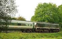
There is also the Enterprise train service connecting the two city regions.

There are three major airports: Dublin Airport (32.9 million passengers; 2018), Belfast International Airport (6.2 million passengers; 2019) and Belfast City Airport (2 million passengers; 2019) which together deal with over 40 million passengers each year.
For the two cities:
- Dublin is served by the Dublin Suburban Rail network, Dublin Bus network, Luas tram network, Dublin Area Rapid Transit and the planned MetroLink.
- Belfast is served by the Belfast Suburban Rail network, Metro (Belfast) bus service, the new Glider (Belfast) bus rapid transport system and some Ulsterbus services.
See also
- Economy of Dublin
- Economy of Belfast
- Cork-Limerick-Galway corridor
- Central belt Scotland (Glasgow-Edinburgh) (3.5m)
- Øresund Region
- Tricity Poland
- List of European city regions
References
- "Archived copy" (PDF). Archived from the original (PDF) on 3 March 2009. Retrieved 28 August 2008.CS1 maint: archived copy as title (link)
- Yarwood, John R (2006). The Dublin-Belfast Development Corridor: Ireland's Mega-City Region?. Ashgate Publishing.