Drygarn Fawr
Drygarn Fawr is a mountain in the county of Powys, Wales. It is one of the highest summits in Mid Wales standing at 645 metres or 2114 feet above sea level. It lies to the south of the Elan Valley Reservoirs. Rising above the remote moorland plateau of the Cambrian Mountains, and to the west of the peaks of Radnor Forest, the summit is topped by two distinctive, large cairns. The mountain has a gentle, grassy, conical shape with a few rocks near the summit. Nearby are the summits of Gorllwyn and Y Gamriw, both over 600m.
| Drygarn Fawr | |
|---|---|
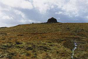 Eastern approach to Drygarn Fawr | |
| Highest point | |
| Elevation | 645 m (2,116 ft) |
| Prominence | 257 m (843 ft) |
| Parent peak | Plynlimon |
| Listing | Marilyn, Hewitt, Nuttall |
| Naming | |
| English translation | Three large cairns |
| Language of name | Welsh |
| Geography | |
| Location | Powys, Wales |
| Parent range | Cambrian Mountains |
| OS grid | SN862584 |
| Topo map | OS Landranger 147 |
| Listed summits of Drygarn Fawr | ||||
| Name | Grid ref | Height | Status | |
|---|---|---|---|---|
| Gorllwyn | SO196643 | 613 metres (2,011 ft) | Hewitt, Nuttall | |
| Y Gamriw | SO213636 | 604 metres (1,982 ft) | sub Hewitt | |
| Darren | SN908568 | 524 metres (1,719 ft) | subdodd | |
| Bryn Du | SN839569 | 555 metres (1,821 ft) | subdodd | |
Walking Routes
There are two paths to the summit which can offer impressive views. From Llannerch Yrfa, a bridleway winds up through forests in the Nant y Fedw valley before skirting the southern edge of the mountain.
An alternative route may be taken starting from Rhiwnant on the edge of the Caban Coch reservoir, one of the Elan Valley Reservoirs, and following the Nant Paradwys before turning off west towards the summit cairn. Both routes pass across wild moorland and peat bogs and the path may become difficult to follow and impassable, particularly after heavy rain.
The views to the north include Pen y Garn and Plynlimon, to the east Rhos Fawr and Gorllwyn and the Brecon Beacons to the south.[1]
References
- Nuttall, John & Anne (1999). The Mountains of England & Wales - Volume 1: Wales (2nd edition ed.). Milnthorpe, Cumbria: Cicerone. ISBN 1-85284-304-7.