Dragash Point
Dragash Point (Bulgarian: нос Драгаш, ‘Nos Dragash’ \'nos 'dra-gash\) is the rocky point forming the south extremity of Dee Island in the South Shetland Islands, Antarctica.

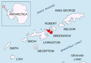
Location of Greenwich Island in the South Shetland Islands.

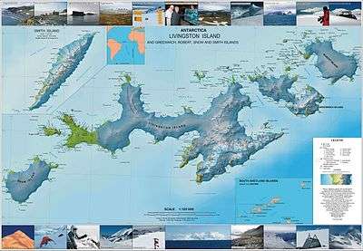
Topographic map of Livingston Island, Greenwich, Robert, Snow and Smith Islands.
The point is named after the settlement of Dragash Voyvoda in Northern Bulgaria.
Location
Dragash Point is located at 62°26′01″S 59°47′44″W, which is 890 m north-northwest of Agüedo Point and 1.06 km northeast of Brusen Point, Greenwich Island. British mapping in 1968, Chilean in 1971, Argentine in 1980, and Bulgarian in 2005 and 2009.
Maps
- L.L. Ivanov et al. Antarctica: Livingston Island and Greenwich Island, South Shetland Islands. Scale 1:100000 topographic map. Sofia: Antarctic Place-names Commission of Bulgaria, 2005.
- L.L. Ivanov. Antarctica: Livingston Island and Greenwich, Robert, Snow and Smith Islands. Scale 1:120000 topographic map. Troyan: Manfred Wörner Foundation, 2009. ISBN 978-954-92032-6-4 (Updated second edition 2010. ISBN 978-954-92032-9-5)
gollark: Most people don't care and tight integration simplifies things.
gollark: Your hope is wrong, then.
gollark: Never outside of really niche things.
gollark: Hmm. This G7 is apparently not really available cheaply locally, has an overly large screen with a notch, and does not have a replaceable battery.
gollark: I would get it if I did not occasionally need android apps and also a working phone.
References
- Dragash Point. SCAR Composite Antarctic Gazetteer
- Bulgarian Antarctic Gazetteer. Antarctic Place-names Commission. (details in Bulgarian, basic data in English)
External links
- Dragash Point. Copernix satellite image
This article includes information from the Antarctic Place-names Commission of Bulgaria which is used with permission.
This article is issued from Wikipedia. The text is licensed under Creative Commons - Attribution - Sharealike. Additional terms may apply for the media files.