Dongluo
Dongluo (simplified Chinese: 东罗镇; traditional Chinese: 東罗鎮; pinyin: Dōngluó Zhèn; zhuang: Dunghloz Cin) is a town under the administration of Fusui County in southern Guangxi Zhuang Autonomous Region, China.[1] As of 2011, it had an area of 215.5 square kilometres (83.2 sq mi) populated by 41,000 people residing in 9 villages. 94% of the people belong to the Zhuang ethnic group.[2]
Dongluo 东罗镇 | |
|---|---|
Town | |
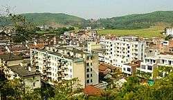 Dongluo town | |
| Coordinates: 22°23′58″N 107°41′06″E | |
| Country | People's Republic of China |
| Region | Guangxi |
| Prefecture-level city | Chongzuo |
| County | Fusui |
| Village-level divisions | 9 villages |
| Area | |
| • Total | 215.5 km2 (83.2 sq mi) |
| Population (2011) | |
| • Total | 41,000 |
| • Density | 190/km2 (490/sq mi) |
| Time zone | UTC+8 (China Standard) |
| Postal code | 532115 |
Administrative divisions
There are 9 villages:[3]
Villages:
- Dongluo (东罗村), Kelan (客兰村), Douchong (都充村), Nalian (那练村), Cenfan (岑凡村), Qukan (渠坎村), Bayang (岜羊村), Dongdou (东斗村), Houzhai (厚寨村)
gollark: A pair of my expensive lattice reactors would make a bit more, probably with less fuel use.
gollark: Terrible efficiency.
gollark: Other fun environmental damage ideas:- cover seas in liquid helium- scatter corium around nice forests
gollark: Great for (literally) covering up reactor meltdowns!
gollark: That is concrete.
References
- 2011年统计用区划代码和城乡划分代码:扶绥县 (in Chinese). National Bureau of Statistics of the People's Republic of China. Archived from the original on 2012-07-21. Retrieved 2013-01-08.
- 2011年统计用区划代码和城乡划分代码:东罗镇 (in Chinese). National Bureau of Statistics of the People's Republic of China. Retrieved 2013-01-03.
- 2011年统计用区划代码和城乡划分代码:东罗镇 中华人民共和国国家统计局 National Bureau of Statistics of the People's Republic of China. Retrieved 2013-01-02.(in Chinese)
This article is issued from Wikipedia. The text is licensed under Creative Commons - Attribution - Sharealike. Additional terms may apply for the media files.