Djifer
Djifer is a coastal village in Fatick Department in Fatick Region, Senegal. It is located 10 km south of Palmarin at the end of the Point of Sangomar.
Djifer | |
|---|---|
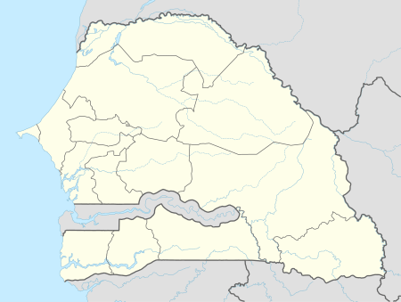 Djifer Location in Fatick Region and Senegal | |
| Coordinates: 13°56′6.2772″N 16°45′46.656″W | |
| Country | |
| Region | Fatick Region |
| Department | Fatick Department |
| Elevation | 13 ft (4 m) |
| Population | |
| • Total | ~2,000 |
| Time zone | UTC+0 (GMT) |
Climate
Djifer has a hot semi-arid climate (BSh) with no rainfall from November to May and moderate to heavy rainfall from June to September.
| Climate data for Djifer | |||||||||||||
|---|---|---|---|---|---|---|---|---|---|---|---|---|---|
| Month | Jan | Feb | Mar | Apr | May | Jun | Jul | Aug | Sep | Oct | Nov | Dec | Year |
| Average high °C (°F) | 31.7 (89.1) |
33.0 (91.4) |
34.1 (93.4) |
33.7 (92.7) |
33.3 (91.9) |
33.3 (91.9) |
31.9 (89.4) |
31.1 (88.0) |
31.7 (89.1) |
33.3 (91.9) |
33.9 (93.0) |
31.9 (89.4) |
32.7 (90.9) |
| Daily mean °C (°F) | 23.9 (75.0) |
24.8 (76.6) |
26.0 (78.8) |
26.4 (79.5) |
26.9 (80.4) |
28.2 (82.8) |
27.8 (82.0) |
27.2 (81.0) |
27.4 (81.3) |
28.0 (82.4) |
27.0 (80.6) |
24.5 (76.1) |
26.5 (79.7) |
| Average low °C (°F) | 16.1 (61.0) |
16.7 (62.1) |
18.0 (64.4) |
19.1 (66.4) |
20.6 (69.1) |
23.1 (73.6) |
23.8 (74.8) |
23.4 (74.1) |
23.2 (73.8) |
22.8 (73.0) |
20.1 (68.2) |
17.1 (62.8) |
20.3 (68.6) |
| Average precipitation mm (inches) | 1 (0.0) |
0 (0) |
0 (0) |
0 (0) |
1 (0.0) |
41 (1.6) |
143 (5.6) |
291 (11.5) |
205 (8.1) |
52 (2.0) |
3 (0.1) |
1 (0.0) |
738 (28.9) |
| Source: Climate-Data.org[1] | |||||||||||||
gollark: No, Richard, it's 'Linux', not 'GNU/Linux'. The most important contributions that the FSF made to Linux were the creation of the GPL and the GCC compiler. Those are fine and inspired products. GCC is a monumental achievement and has earned you, RMS, and the Free Software Foundation countless kudos and much appreciation.Following are some reasons for you to mull over, including some already answered in your FAQ.One guy, Linus Torvalds, used GCC to make his operating system (yes, Linux is an OS -- more on this later). He named it 'Linux' with a little help from his friends. Why doesn't he call it GNU/Linux? Because he wrote it, with more help from his friends, not you. You named your stuff, I named my stuff -- including the software I wrote using GCC -- and Linus named his stuff. The proper name is Linux because Linus Torvalds says so. Linus has spoken. Accept his authority. To do otherwise is to become a nag. You don't want to be known as a nag, do you?(An operating system) != (a distribution). Linux is an operating system. By my definition, an operating system is that software which provides and limits access to hardware resources on a computer. That definition applies whereever you see Linux in use. However, Linux is usually distributed with a collection of utilities and applications to make it easily configurable as a desktop system, a server, a development box, or a graphics workstation, or whatever the user needs. In such a configuration, we have a Linux (based) distribution. Therein lies your strongest argument for the unwieldy title 'GNU/Linux' (when said bundled software is largely from the FSF). Go bug the distribution makers on that one. Take your beef to Red Hat, Mandrake, and Slackware. At least there you have an argument. Linux alone is an operating system that can be used in various applications without any GNU software whatsoever. Embedded applications come to mind as an obvious example.
gollark: Oh, wait, better idea.
gollark: Hey, I *said* (GNU[+/])Linux, isn't that good enough for you, Stallman?!
gollark: Yep!
gollark: Also, though this is more personal preference, (GNU[+/])Linux (distributions) has (have):- a package manager useful for general use (the windows store is not really this)- a usable shell (yes, I'm aware you can use WSL, but it's not very integrated with everything else)- lower resource use- a nicer UI (well, the option for one; AFAIK Windows does not allow as much customization)
References
- "Climate: Djifer". Climate-Data.org. Retrieved August 6, 2020.
This article is issued from Wikipedia. The text is licensed under Creative Commons - Attribution - Sharealike. Additional terms may apply for the media files.