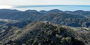
Devils Peak (Santa Barbara County, California)
Devils Peak (or Mount Diablo) at 2,429 feet (740 m) is the tallest peak on the Channel Islands of California. It is located on Santa Cruz Island within Channel Islands National Park on land owned by The Nature Conservancy. Visiting the area requires a permit.[2]
| Devils Peak | |
|---|---|
 Devils Peak and its communications facilities. The peak hosts several radio systems including repeaters for amateur radio and public safety. | |
| Highest point | |
| Elevation | 2,429 ft (740 m) NAVD 88[1] |
| Coordinates | 34°01′45″N 119°47′04″W [1] |
| Geography | |
 Devils Peak  Devils Peak Devils Peak (the United States) | |
| Parent range | Channel Islands |
| Topo map | Santa Cruz Island B |
Devil's Peak is the highest mountain on an ocean island in the contiguous 48 states, edging out Mount Constitution on Orcas Island by a few feet.[3]
References
- "Devils Peak 2". NGS data sheet. U.S. National Geodetic Survey. Retrieved 2009-08-01.
- "Channel Islands National Park Highpoint Information". County Highpointers. Retrieved 2012-05-04.
- "USA 48-States Island High Points above 500 feet". Peakbagger.com. Retrieved 2013-01-17.
External links
- "Island Facts: Santa Cruz Island". Channel Islands National Park, NPS. Retrieved 2008-07-28.
- "Devils Peak, California". Peakbagger.com. Retrieved 2008-07-28.
This article is issued from Wikipedia. The text is licensed under Creative Commons - Attribution - Sharealike. Additional terms may apply for the media files.