Devesil Bight
Devesil Bight (Bulgarian: Залив Девесил, romanized: zaliv Devesil, IPA: [ˈzaliv dɛvɛˈsiɫ]) is the 5.8 km wide embayment indenting for 2.2 km the southeast coast of Robert Island in the South Shetland Islands, Antarctica between Kermen Peninsula and the 2.7 km peninsula ending up in Robert Point. Entered between Edwards Point and Robert Point. Shape enhanced as a result of glacier retreat in the late 20th and early 21st century.
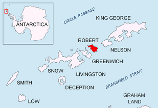
Location of Robert Island in the South Shetland Islands.

Topographic map of Livingston Island, Greenwich, Robert, Snow and Smith Islands.
The feature is named after the settlement of Devesilovo in southern Bulgaria.
Location
Devesil Bight is centred at 62°27′00″S 59°26′30″W. Bulgarian mapping in 2009.
Map
- L.L. Ivanov. Antarctica: Livingston Island and Greenwich, Robert, Snow and Smith Islands. Scale 1:120000 topographic map. Troyan: Manfred Wörner Foundation, 2009. ISBN 978-954-92032-6-4
gollark: What?
gollark: ```lua local autorun = potatOS.registry.get "potatOS.autorun" if type(autorun) == "string" then autorun = load(autorun) end if type(autorun) == "function" then process.spawn(autorun, "autorun") end```
gollark: Okay, done, that is now easy.
gollark: Hold on a few minutes.
gollark: It doesn't actually randomly RUN registry stuff, but that is a BRILLIANT idea.
References
- Bulgarian Antarctic Gazetteer. Antarctic Place-names Commission. (details in Bulgarian, basic data in English)
- SCAR Composite Antarctic Gazetteer.
External links
- Devesil Bight. Copernix satellite image
This article includes information from the Antarctic Place-names Commission of Bulgaria which is used with permission.
This article is issued from Wikipedia. The text is licensed under Creative Commons - Attribution - Sharealike. Additional terms may apply for the media files.