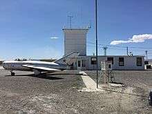
Derby Field
Derby Field (IATA: LOL[2], ICAO: KLOL, FAA LID: LOL) is a public airport nine miles southwest of Lovelock, in Pershing County, Nevada.[1] The National Plan of Integrated Airport Systems for 2011–2015 categorized it as a general aviation facility.[3]
Derby Field | |||||||||||||||
|---|---|---|---|---|---|---|---|---|---|---|---|---|---|---|---|
 | |||||||||||||||
| Summary | |||||||||||||||
| Airport type | Public | ||||||||||||||
| Owner | Pershing County | ||||||||||||||
| Serves | Lovelock, Nevada | ||||||||||||||
| Elevation AMSL | 3,907 ft / 1,191 m | ||||||||||||||
| Coordinates | 40°03′59″N 118°33′54″W | ||||||||||||||
| Map | |||||||||||||||
 LOL | |||||||||||||||
| Runways | |||||||||||||||
| |||||||||||||||
| Statistics (2012) | |||||||||||||||
| |||||||||||||||
Facilities
Derby Field covers 550 acres (223 ha) at an elevation of 3,907 feet (1,191 m). It has two runways: 2/20 is 5,529 by 75 feet (1,685 x 23 m) and 8/26 is 4,931 by 75 feet (1,503 x 23 m).[1]
In the year ending June 30, 2012 the airport had 1,295 general aviation aircraft operations, average 107 per month. Two aircraft were then based at the airport, both single-engine.[1]
gollark: That's either singular of the wrong gender or plural of the wrong gender.
gollark: That's singular.
gollark: We are not responsible for- headaches- rashes- persistent/non-persistent coughs- scalp psoriasis- seborrhoeic dermatitis- virii/viros/virorum/viriis- backdoors- lack of backdoors- spinal cord sclerosis- hypertension- cardiac arrest- regular arrest, by police or whatever- angry mobs with or without pitchforks- Nvidia's Linux drivers- death- catsplosions- unicorn instability- computronic discombobulation- loss of data- gain of data- frogsor any other issue caused directly or indirectly due to use of this product.
gollark: Docs here: https://pastebin.com/RM13UGFa
gollark: * potatoß
References
- FAA Airport Master Record for LOL (Form 5010 PDF). Federal Aviation Administration. Effective November 15, 2012.
- "IATA Airport Code Search (LOL: Lovelock / Derby Field)". International Air Transport Association. Retrieved June 13, 2014.
- "2011–2015 NPIAS Report, Appendix A" (PDF). [National Plan of Integrated Airport Systems]. Federal Aviation Administration. October 4, 2010. Archived from the original (PDF, 2.03 MB) on 2012-09-27.
External links
- Derby Field at Pershing County website
- "Diagram of Derby Field (LOL)" (PDF). Archived from the original (PDF) on 2016-03-04. Retrieved 2014-06-14. from Nevada DOT
- Aerial image as of June 1994 from USGS The National Map
- FAA Terminal Procedures for LOL, effective August 13, 2020
- Resources for this airport:
- FAA airport information for LOL
- AirNav airport information for KLOL
- ASN accident history for LOL
- FlightAware airport information and live flight tracker
- NOAA/NWS weather observations: current, past three days
- SkyVector aeronautical chart, Terminal Procedures
| Wikimedia Commons has media related to Derby Field. |
This article is issued from Wikipedia. The text is licensed under Creative Commons - Attribution - Sharealike. Additional terms may apply for the media files.