Deep Creek (Great Salt Lake)
Deep Creek is a 73-mile (120 km) long[3] tributary of the Great Salt Lake. Beginning at an elevation of 5,339 feet (1,627 m)[2] north of Holbrook in northern Oneida County, Idaho, it flows south into Box Elder County, Utah, passing through Holbrook, Stone, Idaho, Snowville, Utah, and the Curlew Valley. It then flows to its mouth southeast of Kelton, Utah,[4][5] at an elevation of 4,206 feet (1,282 m).[1]
| Deep Creek | |
|---|---|
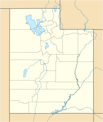 Location of the mouth of Deep Creek in Utah  Deep Creek (Great Salt Lake) (the United States) | |
| Location | |
| Country | United States |
| State | Utah, Idaho |
| Counties | Box Elder County, Utah, Oneida County, Idaho |
| Physical characteristics | |
| Source | |
| • location | north of Holbrook, Oneida County, Idaho |
| • coordinates | 42°21′40″N 112°35′41″W[1] |
| • elevation | 5,339 ft (1,627 m)[2] |
| Mouth | Great Salt Lake |
• location | southeast of Kelton, Box Elder County, Utah |
• coordinates | 41°41′42″N 113°00′26″W[1] |
• elevation | 4,206 ft (1,282 m)[1] |
| Length | 73 mi (117 km)[3] |
References
- "Deep Creek". Geographic Names Information System. United States Geological Survey. June 21, 1979. Retrieved February 9, 2013.
- Source elevation derived from Google Earth search using GNIS source coordinates.
- "National Hydrography Dataset". United States Geological Survey. Retrieved February 9, 2013.
- Utah Road and Recreation Atlas (Map) (4th ed.). 1:250,000. Benchmark Maps. 2011. pp. 35–36. ISBN 978-0-929591-73-5. OCLC 756740229.
- Idaho Road and Recreation Atlas (Map) (2nd ed.). 1:250,000. Benchmark Maps. 2010. pp. 86–87. ISBN 978-0-929591-06-3. OCLC 567571371.
This article is issued from Wikipedia. The text is licensed under Creative Commons - Attribution - Sharealike. Additional terms may apply for the media files.