Dahana Jamoat
Dahana Jamoat is a jamoat (rural municipality) of Kulob District, Khatlon Province, Tajikistan, in central Asia. Its administrative seat is in the town of Dahana. The population of the area was 21,320 in 2008.[1]
Dahana Jamoat | |
|---|---|
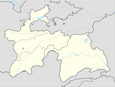
 Dahana Jamoat Location in Tajikistan | |
| Coordinates: 38°03′30″N 069°52′00″E | |
| Country | |
| Province | Khatlon |
| District | Kulob District |
| Population (2008) | |
| • Total | 21,320 |
| Time zone | UTC+5 (TJT) |
The area is almost entirely agricultural, crops and livestock. The farmers utilize the water from the Yakh River (Yakh Su) for irrigation. There is some artisanal mining. Dahana Jamoat suffers from periodic flooding.[2] In May 2010 unusual heavy precipitation triggered avalanches, floods, mud and rock flows, and landslides throughout Kulob District.[3] On 7 May 2010, in Yokhsuchiyon village, mudflows completely destroyed the school building.[4]
Notes
- "List of Jamoats". UN Coordination, Tajikistan. Archived from the original on 26 February 2012.
- "Moving Mountains: UN Disaster Risk Management Project 2004-2006". Government of the Republic of Tajikistan and the United Nations Development Programme. Archived from the original on 11 October 2012.
- REACT (Rapid Emergency Assessment and Coordination Team) (19 May 2010). "REACT Flood Appeal for East Khatlon, Tajikistan" (PDF). Dushanbe, Tajikistan: United Nations, Tajikistan. p. 3. Archived from the original (PDF) on 11 October 2012.
- REACT 2010, p. 54
gollark: Who hath pinged my name?
gollark: Apparently back very BRIEFLY, since while my computer is working I've still got the annoying random crashiness!
gollark: Oh.
gollark: It had better be nice looking.
gollark: umwn: yes.
This article is issued from Wikipedia. The text is licensed under Creative Commons - Attribution - Sharealike. Additional terms may apply for the media files.