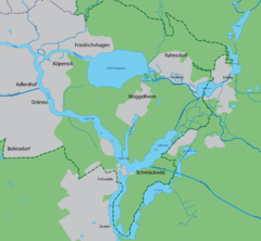
Dämeritzsee
The Dämeritzsee (![]()
| Dämeritzsee | |
|---|---|
 | |
| Location | Brandenburg / Berlin |
| Coordinates | 52°25′22″N 13°44′2″E |
| Primary inflows | Spree, Flakenfließ |
| Primary outflows | Müggelspree |
| Basin countries | Germany |
| Surface area | 93.5 hectares (231 acres) |
| Max. depth | 4.5 metres (15 ft) |
| Surface elevation | 32 metres (105 ft) |
| Settlements | Berlin, Erkner |
The lake forms part of the course of the River Spree, and is the location of that river's confluence with the short Flakenfließ that flows out of the Flakensee. The reach of the Spree downstream to the Müggelsee is also known as the Müggelspree.[1]
The Muggelspree and the Flakenfließ are both navigable, and the lake is also linked to the nearby Seddinsee by the Gosen Canal. The lake sees considerable sightseeing and leisure traffic, and also forms a link in a commercial navigation route from the limestone workings at Rüdersdorf, which reaches the Flakensee by a lock at Woltersdorf, and connects to the River Dahme and the Oder-Spree Canal via the Seddinsee.[1]
References
- Sheffield, Barry (1995). Inland Waterways of Germany. St Ives: Imray Laurie Norie & Wilson. pp. 113–122. ISBN 0-85288-283-1.
External links
- Nixdorf, B.; et al. (2004), "Dämeritzsee", Dokumentation von Zustand und Entwicklung der wichtigsten Seen Deutschlands (in German), Berlin: Umweltbundesamt, p. 4