Craigierig
Craigierig is a village on the Megget Reservoir, in the Scottish Borders area of Scotland, in the former Selkirkshire.
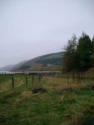
Craigierig on the Megget Reservoir
Places nearby include the Glengaber Burn, Henderland, St Mary's Loch, the Tibbie Shiels Inn, and Yarrow Water.
References
- Lonie, W (1995), 'Droveway sign-wall'
- The Geological Society, Scottish Journal of Geology, A new, stratigraphically significant Torquigraptus species (Silurian graptolite) from the Southern Uplands Terrane, Mark Williams et al.
- Proc Soc Antiq Scot, 1981, 401-429: Cramalt tower: historical survey and excavations 1977-9 by Alastair M T Maxwell-Irving
External links
- RCAHMS record of Craigie Rig, Craigierig
- CANMORE/RCAHMS record of Craigie Rig
- RCAHMS record of Glengaber Burn
- Geograph image: Craigierig Farm, viewed from Syart Law and up by Yair Sike towards Black Pig
This article is issued from Wikipedia. The text is licensed under Creative Commons - Attribution - Sharealike. Additional terms may apply for the media files.