County of Solander
The county of Solander is a cadastral division of Queensland which contains the towns of Ayton, Daintree, Mossman and Port Douglas. It was originally the southern part of the county of Banks when the counties were named and bounded in 1901.[1][2]
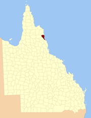
| Solander Queensland | |||||||||||||||
|---|---|---|---|---|---|---|---|---|---|---|---|---|---|---|---|
 Location within Queensland | |||||||||||||||
| |||||||||||||||
Parishes
Solander is subdivided into parishes, listed as follows:
| Parish | LGA | Coordinates | Towns |
|---|---|---|---|
| Alexandra | Douglas | 16°12′S 145°29′E | Alexandra Bay |
| Amy | Douglas | 16°4′S 144°57′E | |
| Bloomfield | Douglas | 16°4′S 145°9′E | |
| Clerk | Cook | 15°54′S 145°17′E | Ayton |
| Dagmar | Douglas | 16°13′S 145°12′E | |
| Dedin | Douglas | 16°22′S 145°16′E | |
| Kingsdale | Cook | 15°47′S 144°57′E | |
| Mowbray | Douglas | 16°36′S 145°27′E | |
| Noah | Douglas | 16°6′S 145°21′E | Cape Tribulation |
| Phipps | Cook | 15°50′S 145°7′E | |
| Salisbury | Douglas | 16°32′S 145°26′E | Port Douglas |
| Sporing | Cook | 15°55′S 145°6′E | |
| Spurgeon | Douglas | 16°13′S 145°4′E | |
| Tribulation | Douglas | 16°00′S 145°22′E | |
| Victory | Douglas | 16°30′S 145°21′E | Mossman |
| Whyanbeel | Douglas | 16°22′S 145°22′E | Daintree |
gollark: Lighting idea: simulate bright lighting on a much lower power budget using dim and somewhat unfocused lasers, computer vision-y cameras and digital light processing to aim """"safe"""" beams directly into people's eyes.
gollark: Automatically order in new ones upon failure.
gollark: Just use better plastic.
gollark: Lighting idea: heat up LEDs enough that they glow incandescently.
gollark: I didn't even get to read that because the messages were [REDACTED].
References
- "Solander - county (entry 31356)". Queensland Place Names. Queensland Government. Retrieved 21 June 2017.
- Cook District, County of Solander Maps - Q4 Series at Queensland Archives.
External links
This article is issued from Wikipedia. The text is licensed under Creative Commons - Attribution - Sharealike. Additional terms may apply for the media files.