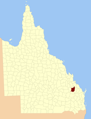
County of Rawbelle
The County of Rawbelle is a county (a cadastral division) in Queensland, Australia, located in the Wide Bay–Burnett region.[1][2] On 7 March 1901, the Governor issued a proclamation legally dividing Queensland into counties under the Land Act 1897.[3] Its schedule described Rawbelle thus:
Bounded on the south by the county of Wicklow; on the west by the eastern watershed of the Dawson River; on the north by the northern watersheds of Rawbelle River and Three Moon Creek; and on the east by the county of Yarrol.
| Rawbelle Queensland | |||||||||||||||
|---|---|---|---|---|---|---|---|---|---|---|---|---|---|---|---|
 Location within Queensland | |||||||||||||||
| |||||||||||||||
Parishes
Rawbelle is divided into parishes, as listed below:
| Parish | LGA | Coordinates | Towns |
|---|---|---|---|
| Bailey | North Burnett | 24°54′S 151°04′E | Monto, Mulgildie |
| Bingmann | North Burnett | 24°48′S 150°53′E | |
| Calrossie | North Burnett | 25°14′S 150°35′E | |
| Cania | North Burnett | 24°32′S 151°00′E | |
| Clonmel | North Burnett | 24°43′S 151°04′E | |
| Coominglah | North Burnett | 24°55′S 150°56′E | |
| Coppin | North Burnett | 24°48′S 151°04′E | Moonford, Mungungo |
| Culcraigie | North Burnett | 25°16′S 151°01′E | |
| Harrami | North Burnett | 24°47′S 150°42′E | |
| Monal | North Burnett | 24°34′S 151°06′E | |
| Montour | North Burnett | 24°56′S 150°40′E | |
| Mungon | North Burnett | 25°07′S 150°58′E | Wuruma Dam |
| Rawbelle | North Burnett | 24°59′S 150°49′E | |
| Selene | North Burnett | 25°02′S 151°06′E | |
| Telemark | North Burnett | 25°18′S 150°50′E | |
| Tireen | North Burnett | 25°10′S 150°41′E | |
| Trevethan | North Burnett | 25°05′S 150°39′E | |
| Yule | North Burnett | 25°10′S 150°51′E |
gollark: ... and machines, and their own buffers, because RF is stupid and basically just a liquid.
gollark: Well, and the powercells, unavoidably.
gollark: No buffers except for the reactor output.
gollark: My stuff runs on thermal dynamics fluxducts and RFTools powercells.
gollark: Just use quantum entangloporters everywhere.
References
- "Rawbelle (entry 28077)". Queensland Place Names. Queensland Government. Retrieved 8 September 2015.
- Wide Bay/Burnett Districts, County of Rawbelle Maps – E1 Series at Queensland Archives.
- "A Proclamation". Queensland Government Gazette. 75. 8 March 1901. pp. 967–980.
External links
This article is issued from Wikipedia. The text is licensed under Creative Commons - Attribution - Sharealike. Additional terms may apply for the media files.