Connecticut Route 94
Route 94 is an east–west state highway in Connecticut running for 9.33 miles (15.02 km) from Route 2 (Exit 8) in Glastonbury to Route 85 in Hebron.
| ||||
|---|---|---|---|---|
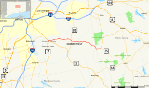 Map of central Connecticut with Route 94 highlighted in red | ||||
| Route information | ||||
| Maintained by ConnDOT | ||||
| Length | 9.33 mi[1] (15.02 km) | |||
| Existed | 1932[2]–present | |||
| Major junctions | ||||
| West end | ||||
| East end | ||||
| Location | ||||
| Counties | Hartford, Tolland | |||
| Highway system | ||||
| ||||

Route description
Route 94 officially begins as the Exit 8 offramp of eastbound Route 2 in western Glastonbury (in the Addison section of town). It turns east on Hebron Avenue and crosses under the Route 17 expressway without an interchange, and then under Route 2 (about 330 yards (300 m) east of the end of the eastbound offramp). Hebron Avenue continues eastward through Glastonbury for another 3.75 miles (6.04 km), meeting with Route 83 (which heads for Manchester and East Glastonbury). After another 1.1 miles (1.8 km), it crosses Roaring Brook and becomes mainly a rural collector road as it heads towards the town of Hebron. Along the way it passes by the Macclain Earth Products factory as it traverses the rural part of Glastonbury. Route 94 crosses into the town of Hebron about 3.3 miles (5.3 km) east of Roaring Brook becoming known as Gilead Street, where it ends 0.8 miles (1.3 km) east of the town line at an intersection with Route 85. Gilead Street continues further east as southbound Route 85 towards the town center of Hebron.[1]
Route 94 is designated the 94th Infantry Division Memorial Highway from Route 2 to the Glastonbury-Hebron town line.[3]
History
In the early 1920s, State Highway 165 was designated as the road from Main Street in Glastonbury Center (at New England Route 17), through Addison, to then State Highway 164 (now Route 83). In the 1932 state highway renumbering,[2] modern Route 94 was created from the entire length of former Highway 165 as well as an eastward extension to newly established Route 85 in Hebron. In 1957, when after the portion of the Route 2 expressway in Glastonbury opened, Route 2 was relocated to the new expressway and the western terminus of Route 94 was also moved to the current location. There have also been several curves straightened in Glastonbury between 1958 and 2004.[4]
Junction list
| County | Location | mi[1] | km | Destinations | Notes | ||
|---|---|---|---|---|---|---|---|
| Hartford | Glastonbury | 0.00– 0.49 | 0.00– 0.79 | Exit 8 (Route 2) | |||
| 4.14 | 6.66 | ||||||
| Tolland | Hebron | 9.33 | 15.02 | ||||
| 1.000 mi = 1.609 km; 1.000 km = 0.621 mi | |||||||
References
- Connecticut State Highway Log Archived 2015-07-26 at WebCite
- "Road Conditions in Connecticut". The Hartford Daily Courant. September 17, 1932. p. 18. Retrieved December 24, 2019 – via Newspapers.com.

- State Roads and Bridges with Names Commemorating Veterans Organizations or Groups
- Connecticut Routes, Route 94