Collores, Orocovis, Puerto Rico
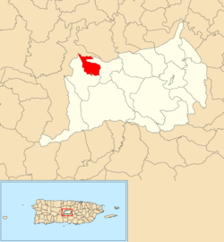
Collores is a barrio in the municipality of Orocovis, Puerto Rico. Its population in 2010 was 152.[3][4][5]
Collores | |
|---|---|
Barrio | |
 Location of Collores within the municipality of Orocovis shown in red | |
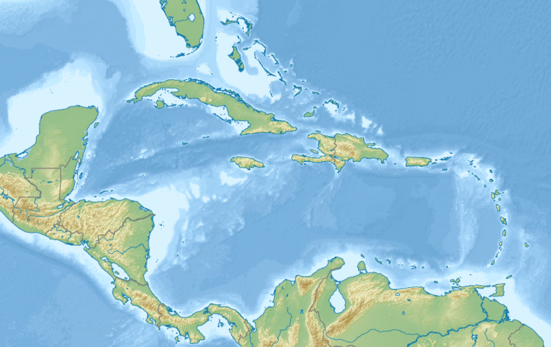
 Collores Location of Puerto Rico | |
| Coordinates: 18°14′29″N 66°29′14″W[1] | |
| Commonwealth | |
| Municipality | |
| Area | |
| • Total | 1.49 sq mi (3.9 km2) |
| • Land | 1.49 sq mi (3.9 km2) |
| • Water | 0 sq mi (0 km2) |
| Elevation | 1,247 ft (380 m) |
| Population (2010) | |
| • Total | 152 |
| • Density | 102/sq mi (39/km2) |
| Source: 2010 Census | |
| Time zone | UTC−4 (AST) |
History
The United States took control of Puerto Rico from Spain in the aftermath of the Spanish-American War under the terms of the Treaty of Paris of 1898. In 1899, the United States conducted its first census of Puerto Rico finding that the combined population of Collores and Cacaos barrios was 1,588.[6]
gollark: There's the "wash your hands" campaigns and apparently the government's trying to deal with the economic impact later, but we're doing horribly on testing (better than the US...) and seemingly not actually doing much to stop the spread preemptively.
gollark: I'm worried that the UK appears to not actually be doing much about coronavirus.
gollark: https://twitter.com/ScottGottliebMD/status/1224042220665307137
gollark: Apparently hospitals could test for coronavirus cheaply with stuff they generally already had available, but the FDA only allowed the CDC's tests to be used. But those had a broken component. Hospitals also had replacements for that broken bit, but the way the tests were licensed didn't allow them to be replaced. So they just limited testing to those returning from China, so they have no idea of spread.
gollark: The whole thing with the FDA/CDC managing to horribly mess up testing.
See also
References
- "US Gazetteer 2019". US Census. US Government.
- U.S. Geological Survey Geographic Names Information System: Collores barrio
- Picó, Rafael; Buitrago de Santiago, Zayda; Berrios, Hector H. Nueva geografía de Puerto Rico: física, económica, y social, por Rafael Picó. Con la colaboración de Zayda Buitrago de Santiago y Héctor H. Berrios. San Juan Editorial Universitaria, Universidad de Puerto Rico,1969.
- Gwillim Law (20 May 2015). Administrative Subdivisions of Countries: A Comprehensive World Reference, 1900 through 1998. McFarland. p. 300. ISBN 978-1-4766-0447-3. Retrieved 25 December 2018.
- Puerto Rico:2010:population and housing unit counts.pdf (PDF). U.S. Dept. of Commerce, Economics and Statistics Administration, U.S. Census Bureau. 2010.
- Joseph Prentiss Sanger; Henry Gannett; Walter Francis Willcox (1900). Informe sobre el censo de Puerto Rico, 1899, United States. War Dept. Porto Rico Census Office (in Spanish). Imprenta del gobierno. p. 165.
This article is issued from Wikipedia. The text is licensed under Creative Commons - Attribution - Sharealike. Additional terms may apply for the media files.