Col de Beixalis
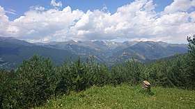
The Col de Beixalis, or Collada de Beixalis, is a mountain pass at an altitude of 1,795 metres (5,889 ft)[1] located in Andorra.
| Col de Beixalis | |
|---|---|
| Collada de Beixalis | |
 | |
| Elevation | 1,795 m (5,889 ft)[1] |
| Location | Encamp, Andorra |
| Range | Pyrenees |
| Coordinates | 42°31′50.8764″N 1°33′9.072″E |
 Col de Beixalis The Col de Beixalis within Andorra | |
The road is situated between Anyós to the west and Encamp to the east. Until recently, the last 2.5 kilometres (1.6 mi) on the eastern side of the climb was a gravel road, which has now been paved.[2][3]
The route from the eastern side was used on Stage 9 of the 2016 Tour de France.[4]
References
- "Collada de Beixalis". Cycling Locations. Retrieved 8 July 2016.
- "Collada de Beixalis". Dangerousroads. Retrieved 8 July 2016.
- "Colada de Beixalís, el nuevo "muro" Andorrano" [Collada de Beixalís, the new Andorran "wall"]. ramacabici.com (in Spanish). Retrieved 8 July 2016.
- "TDF16 ET09 parcours" (PDF). Tour de France. Amaury Sport Organisation. Archived from the original (PDF) on 5 July 2016. Retrieved 8 July 2016.
This article is issued from Wikipedia. The text is licensed under Creative Commons - Attribution - Sharealike. Additional terms may apply for the media files.