Cocos, Quebradillas, Puerto Rico
Cocos is a barrio in the municipality of Quebradillas, Puerto Rico. Its population in 2010 was 4,889.[3][4][5]
Cocos | |
|---|---|
Barrio | |
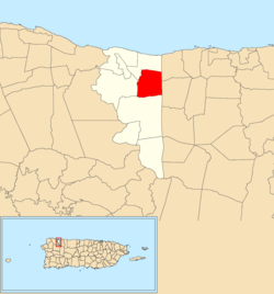 Location of Cocos within the municipality of Quebradillas shown in red | |
 Cocos Location of Puerto Rico | |
| Coordinates: 18°27′24″N 66°54′45″W[1] | |
| Commonwealth | |
| Municipality | |
| Area | |
| • Total | 2.46 sq mi (6.4 km2) |
| • Land | 2.46 sq mi (6.4 km2) |
| • Water | 0 sq mi (0 km2) |
| Elevation | 459 ft (140 m) |
| Population (2010) | |
| • Total | 4,889 |
| • Density | 1,987.4/sq mi (767.3/km2) |
| Source: 2010 Census | |
| Time zone | UTC−4 (AST) |
History
The United States took control of Puerto Rico from Spain in the aftermath of the Spanish-American War under the terms of the Treaty of Paris of 1898. In 1899, the United States conducted its first census of Puerto Rico finding that the population of Cocos barrio was 978.[6]
Sectors
Barrios (which are like minor civil divisions)[7] in turn are further subdivided into smaller local populated place areas/units called sectores (sectors in English). The types of sectores may vary, from normally sector to urbanización to reparto to barriada to residencial, among others.[8][9][10][11][12]
The following sectors are in Cocos barrio:[13]
Calle La Ceiba, Calle Lucía Rivera, Calle Socorro, Calle Vicentita Delís, Carretera 482, Carretera 483, Carretera 485, Carretera Ramal 484, Extensión Lamela, Parcelas Los Cocos, Reparto Amador, Reparto Bordel, Residencial Francisco Vigo Salas, Residencial Villa Julia, Sector Arturo Jiménez, Sector Cuatro Calles, Sector Dámaso Soto, Sector El Verde, Sector Felipe Cruz, Sector Hoyo Brujo (Fito Valle), Sector Julián Hernández, Sector La Ceiba, Sector La Cuesta, Sector Lajas, Sector Las Piedras, Sector Los González, Sector Los Lugo, Sector Los Paganes, Sector Pallens, Urbanización Ávila, Urbanización El Retiro, Urbanización Hacienda Guadalupe, Urbanización Kennedy, Urbanización Las Ceibas (from km 99.1 of Carretera 2), and Urbanización Villa Norma.
See also
References
- "US Gazetteer 2019". US Census. US Government.
- U.S. Geological Survey Geographic Names Information System: Cocos barrio
- Picó, Rafael; Buitrago de Santiago, Zayda; Berrios, Hector H. Nueva geografía de Puerto Rico: física, económica, y social, por Rafael Picó. Con la colaboración de Zayda Buitrago de Santiago y Héctor H. Berrios. San Juan Editorial Universitaria, Universidad de Puerto Rico,1969.
- Gwillim Law (20 May 2015). Administrative Subdivisions of Countries: A Comprehensive World Reference, 1900 through 1998. McFarland. p. 300. ISBN 978-1-4766-0447-3. Retrieved 25 December 2018.
- Puerto Rico:2010:population and housing unit counts.pdf (PDF). U.S. Dept. of Commerce, Economics and Statistics Administration, U.S. Census Bureau. 2010.
- Joseph Prentiss Sanger; Henry Gannett; Walter Francis Willcox (1900). Informe sobre el censo de Puerto Rico, 1899, United States. War Dept. Porto Rico Census Office (in Spanish). Imprenta del gobierno. p. 161.
- "US Census Barrio-Pueblo definition". factfinder.com. US Census. Archived from the original on 13 May 2017. Retrieved 5 January 2019.
- Mari Mut, José A. (28 August 2013). "Los pueblos de Puerto Rico y las iglesias de sus plazas" (in Spanish). Retrieved 19 June 2020 – via archive.org.
- "Agencia: Oficina del Coordinador General para el Financiamiento Socioeconómico y la Autogestión (Proposed 2016 Budget)". Puerto Rico Budgets (in Spanish). Retrieved 28 June 2019.
- Rivera Quintero, Marcia (2014), El vuelo de la esperanza : Proyecto de las Comunidades Especiales Puerto Rico, 1997-2004 (Primera edición ed.), San Juan, Puerto Rico Fundación Sila M. Calderón, ISBN 978-0-9820806-1-0
- "Leyes del 2001". Lex Juris Puerto Rico (in Spanish). Retrieved 24 June 2019.
- "Comunidades Especiales de Puerto Rico" (in Spanish). 8 August 2011. Retrieved 24 June 2019.
- "PRECINTO ELECTORAL QUEBRADILLAS 031" (PDF). Comisión Estatal de Elecciones (in Spanish). PR Government. 21 September 2019. Retrieved 26 July 2020.