Cliff Dwellers Airport
Cliff Dwellers Airport or Cliff Dwellers Lodge Airport (FAA LID: AZ03) is a private use non-towered airport owned by the Bureau of Land Management located 8 miles (7.0 nmi; 13 km) southwest of Marble Canyon Airport and the town of Marble Canyon, in Coconino County, Arizona, United States.[1] This airport is 195 miles (169 nmi; 314 km) east of Las Vegas McCarran International Airport, the closest major airport with airline service.
Cliff Dwellers Airport | |||||||||||
|---|---|---|---|---|---|---|---|---|---|---|---|
 | |||||||||||
| Summary | |||||||||||
| Airport type | Private | ||||||||||
| Owner | Bureau of Land Management | ||||||||||
| Serves | Marble Canyon | ||||||||||
| Elevation AMSL | 4,217 ft / 1,285 m | ||||||||||
| Coordinates | 36°44′03″N 111°45′10″W | ||||||||||
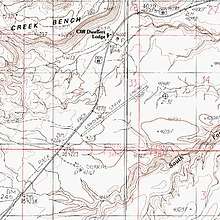
| Map | |||||||||||
 AZ03  AZ03 | |||||||||||
| Runways | |||||||||||
| |||||||||||
| Statistics (2015) | |||||||||||
| |||||||||||
Source: Federal Aviation Administration | |||||||||||
Although most U.S. airports use the same three-letter location identifier for the FAA, IATA, and ICAO, this airport is only assigned AZ03 by the FAA.[2]
Facilities and aircraft
Cliff Dwellers Airport covers an area of 68 acres (28 ha) at an elevation of 4,217 ft (1,285 m) above mean sea level. It has one runway:
For the 12-month period ending April 23, 2015, the airport had three aircraft based at this airport: 100% single-engine.
References
- "AirportIQ 5010". www.gcr1.com. Retrieved 2018-05-24.
- "AZ03 - Marble Canyon [Cliff Dwellers Airport], AZ, US - Airport - Great Circle Mapper". www.gcmap.com. Retrieved 2018-05-24.
- "AirNav: AZ03 - Cliff Dwellers Airport". www.airnav.com. Retrieved 2018-05-24.
- "AOPA Airports". www.aopa.org. Retrieved 2018-05-24.
External links
- FAA Terminal Procedures for AZ03, effective August 13, 2020
- Resources for this airport:
- FAA airport information for AZ03
- AirNav airport information for KAZ03
- FlightAware airport information and live flight tracker
- NOAA/NWS weather observations: current, past three days
- SkyVector aeronautical chart, Terminal Procedures