Clements Mountain
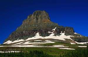
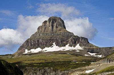
Clements Mountain (8,765 feet (2,672 m)) is located in the Lewis Range, Glacier National Park in the U.S. state of Montana.[3] Clements Mountain rises to the west of Logan Pass and above the Hidden Lake Trail which leads to Hidden Lake just west of the continental divide. The peak was named after Walter M. Clements who had worked to set up a treaty between the Blackfeet and the U.S. Government for the purchase of tribal lands east of the continental divide which later became part of the park.[4]
| Clements Mountain | |
|---|---|
 Clements Mountain | |
| Highest point | |
| Elevation | 8,765 ft (2,672 m) [1] NAVD 88 |
| Prominence | 920 ft (280 m) [1] |
| Coordinates | 48°41′35″N 113°44′25″W[2] |
| Geography | |
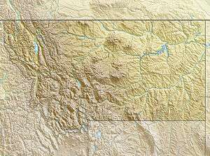
 Clements Mountain Location in Montana  Clements Mountain Location in the United States | |
| Location | Glacier County, Montana, Flathead County, Montana, U.S. |
| Parent range | Lewis Range |
| Topo map | USGS Logan Pass, MT |
| Climbing | |
| First ascent | August 13, 1923 (Norman Clyde)[1] |
Geology
Like other mountains in Glacier National Park, Clements Mountain is composed of sedimentary rock laid down during the Precambrian to Jurassic periods. Formed in shallow seas, this sedimentary rock was initially uplifted beginning 170 million years ago when the Lewis Overthrust fault pushed an enormous slab of precambrian rocks 3 mi (4.8 km) thick, 50 miles (80 km) wide and 160 miles (260 km) long over younger rock of the cretaceous period.[5]

See also
References
- "Clements Mountain, Montana". Peakbagger.com. Retrieved June 7, 2018.
- "Clements Mountain". Geographic Names Information System. United States Geological Survey. Retrieved June 7, 2018.
- Logan Pass, MT (Map). TopoQwest (United States Geological Survey Maps). Retrieved June 7, 2018.
- "Clements Mountain". SummitPost.org. Retrieved 2011-05-09.
- Gadd, Ben (2008). "Geology of the Rocky Mountains and Columbias". Cite journal requires
|journal=(help)
External links
- Clements Mountain: Weather