Cintray, Eure
Cintray is a former commune in the Eure department in northern France. On 1 January 2016, it was merged into the commune of Breteuil.[2]
Cintray | |
|---|---|
Part of Breteuil | |
Location of Cintray 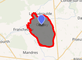
| |
 Cintray  Cintray | |
| Coordinates: 48°47′46″N 0°53′30″E | |
| Country | France |
| Region | Normandy |
| Department | Eure |
| Arrondissement | Bernay |
| Canton | Breteuil |
| Commune | Breteuil |
| Area 1 | 16.27 km2 (6.28 sq mi) |
| Population (2017)[1] | 462 |
| • Density | 28/km2 (74/sq mi) |
| Time zone | UTC+01:00 (CET) |
| • Summer (DST) | UTC+02:00 (CEST) |
| Postal code | 27160 |
| Elevation | 165–184 m (541–604 ft) (avg. 176 m or 577 ft) |
| 1 French Land Register data, which excludes lakes, ponds, glaciers > 1 km2 (0.386 sq mi or 247 acres) and river estuaries. | |
Population
| Year | Pop. | ±% |
|---|---|---|
| 1962 | 286 | — |
| 1968 | 319 | +11.5% |
| 1975 | 277 | −13.2% |
| 1982 | 294 | +6.1% |
| 1990 | 375 | +27.6% |
| 1999 | 361 | −3.7% |
| 2008 | 408 | +13.0% |
gollark: Great, instantaneously materializing metatemporal spheres...
gollark: Presumably. You can also just express an interest in the product and we will automatically exchange capital.
gollark: The GTech™ website. We will ship by railgun or any other approved method once purchase is confirmed.
gollark: Just 83, it is on sale.
gollark: Then purchase a GTech™ metatemporal sphere.
See also
References
- Téléchargement du fichier d'ensemble des populations légales en 2017, INSEE
- Arrêté préfectoral 9 December 2015 (in French)
| Wikimedia Commons has media related to Cintray (Eure). |
| Authority control |
|
|---|
This article is issued from Wikipedia. The text is licensed under Creative Commons - Attribution - Sharealike. Additional terms may apply for the media files.