Chinook River
The Chinook River is a short stream located near the mouth of the Columbia River in the U.S. state of Washington.
| Chinook River | |
|---|---|
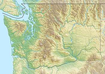 Location of the mouth of the Chinook River in Washington | |
| Location | |
| Country | United States |
| State | Washington |
| County | Pacific |
| Physical characteristics | |
| Source | Willapa Hills |
| • coordinates | 46°16′0″N 123°53′10″W[1][2] |
| • elevation | 900 ft (270 m)[3] |
| Mouth | Columbia River |
• location | Baker Bay |
• coordinates | 46°18′7″N 123°58′19″W[1] |
• elevation | 0 ft (0 m) |
| Length | 6.5 mi (10.5 km)[4] |
| Basin size | 13.6 sq mi (35 km2)[5] |
Course
The Chinook River originates just north of the Astoria–Megler Bridge, near Scarboro Hill in the Willapa Hills. The river flows west and northwest, just north of Fort Columbia State Park, Chinook Point, and the small town of Chinook on the Columbia River.
Its lower course runs through the Chinook Wildlife Area.[6] The river empties into Baker Bay, part of the Columbia River, at Stringtown, about 2 mi (3.2 km) east of Ilwaco. Baker Bay is part of the Columbia River Estuary and located just east of Cape Disappointment and the Pacific Ocean.[2]
gollark: OH APIOOPSISS
gollark: It's better on heavserver. I got 3 bots to stream into #text.
gollark: While you've been distracted HERE, I accessed heavserver.
gollark: ~play communism flawed
gollark: ~play socialism bad and unamazing
See also
- List of rivers of Washington
- Tributaries of the Columbia River
References
- U.S. Geological Survey Geographic Names Information System: Chinook River
- USGS topographic maps accessed via https://mapper.acme.com
- GeoLocator
- Measured using GNIS coordinates, Google Map, and ACME Mapper 2.2
- "Chinook River, Washington". The Columbia River - A Photographic Journey. Retrieved 1 September 2019.
- "Chinook Wildlife Area Unit". Washington State Department of Fish and Wildlife. Retrieved 1 September 2019.
This article is issued from Wikipedia. The text is licensed under Creative Commons - Attribution - Sharealike. Additional terms may apply for the media files.