Chickatawbut
Chickatawbut (died in 1633) (also known as Cicatabut and possibly Oktabiest before 1622) was the sachem, or leader, of a large group of indigenous people of what is now eastern Massachusetts, United States, known as the Massachusett tribe, during the initial period of English settlement in the region in the early seventeenth century.[1] In 1630 Chickatawbut deeded the land that is now Boston to the Puritans.[2]

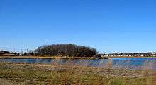
Chickatawbut's home base was Conihasset, near modern Scituate.[3] The sachem's name had many variant spellings in early Massachusetts records. Some argue that he had an alternate name, Oktabiest [4] His brother was Wassapinewat.[5] Chickatawbut maintained a base at a small hill on Quincy Bay in Boston Harbor known as Moswetuset Hummock. He was met there by Plymouth Colony commander Myles Standish and Tisquantum, a Patuxet guide, in 1621.[6][7] According to Thomas Morton, "Chickatawbut’s mother was buried at Passonagessit, and that the Plymouth people, on one of their visits, incurred his enmity by despoiling her grave of its bear skins,"[8] but despite this, Chickatawbut did not get caught alongside his warrior, Pecksuot, in the hostilities at the Wessagusset Colony in 1623/24. Chickatawbut's died of smallpox in 1633 and was succeeded as sachem by his brother, Cutshamekin, who was in turn succeeded around 1655 by Chickatawbut's son, Wompatuck, who became a leader of the Mattakeesett tribe and a friend of the English settlers.
Chickatawbut Road, one of the Blue Hills Reservation Parkways, and Chickatawbut Hill, at 517 feet (158 m) the highest point in Quincy, Massachusetts, are named for him.[9]
In 1650, five Massachusett Indians testified to the tribal bounds over which Chickatawbut reigned:
Pecunke, Ahivmpum, Catscimah, Webacowett, and Masbanomett doe all afferme, that Chickatawbutt his bounds did extend from Nishamagoquanett, near Duxbery mill [near present-day Cow Tent Hill Preserve off Tremont St. in Duxbury], to Teghtacutt, neare Taunton [Titicut], and to Nunckatatesett, and from thence in a straight linne to Wanamampuke, which is the head of Charles Riuer ; this they doe all solomly afferme, saing, God knoweth it to bee true, and knoweth theire harts. Dated the first of the fourth month, 1650. Wittnes : Encrease Nowell, John Eliot, John Hoare.[10]
References
- Morton, Thomas (1883). Charles Francis Adams Jr. (ed.). The new English Canaan of Thomas Morton. Boston: The Prince Society. pp. 11. OCLC 28272732. Retrieved 2009-10-14.
- OBJECT OF THE MONTH OBJECT OF THE MONTH ARCHIVE ABOUT Indian deed for Boston, 19 March 1685, September 2006, Carrie Supple, Assistant Reference Librarian https://www.masshist.org/object-of-the-month/objects/indian-deed-for-boston-2006-09-01
- Jeremy Dupertuis Bangs, Indian Deeds: Land Transactions in Plymouth Colony. Boston: New England Historic Genealogical Society, 2002, maps
- Bangs 2002, p. 14.
- https://yipp.yale.edu/bio/bibliography/obtakiest-1633
- "East Squantum Street (Moswetuset Hummock)". Quincy, Mass. Historical and Architectural Survey. Thomas Crane Public Library. 1986. Retrieved 2009-06-24.
- Neal, Daniel (1747). "XIV: The Present State of New England". The history of New-England. 2 (2 ed.). London: Printed for A. Ward. p. 216. OCLC 8616817. Retrieved 2009-06-24.
- Title: The New English Canaan of Thomas Morton with Introductory Matter and Notes; Author: Thomas Morton and Charles Francis Adams http://www.gutenberg.org/files/54162/54162-0.txt
- Douglas-Lithgow, Robert Alexander (1909). Dictionary of American-Indian place and proper names in New England. Salem, Massachusetts: Salem Press. pp. 9. OCLC 621081. Retrieved 2009-10-14.
- "Records of the colony of New Plymouth in New England. Court Orders. Vol. II. 1641-1651" (PDF).